
Barker Hut Route – The Gatekeeper Stronghold to the Glaciers…
Barker Hut Route
19/04/19 ~ 22/04/19
Information
Map
Location
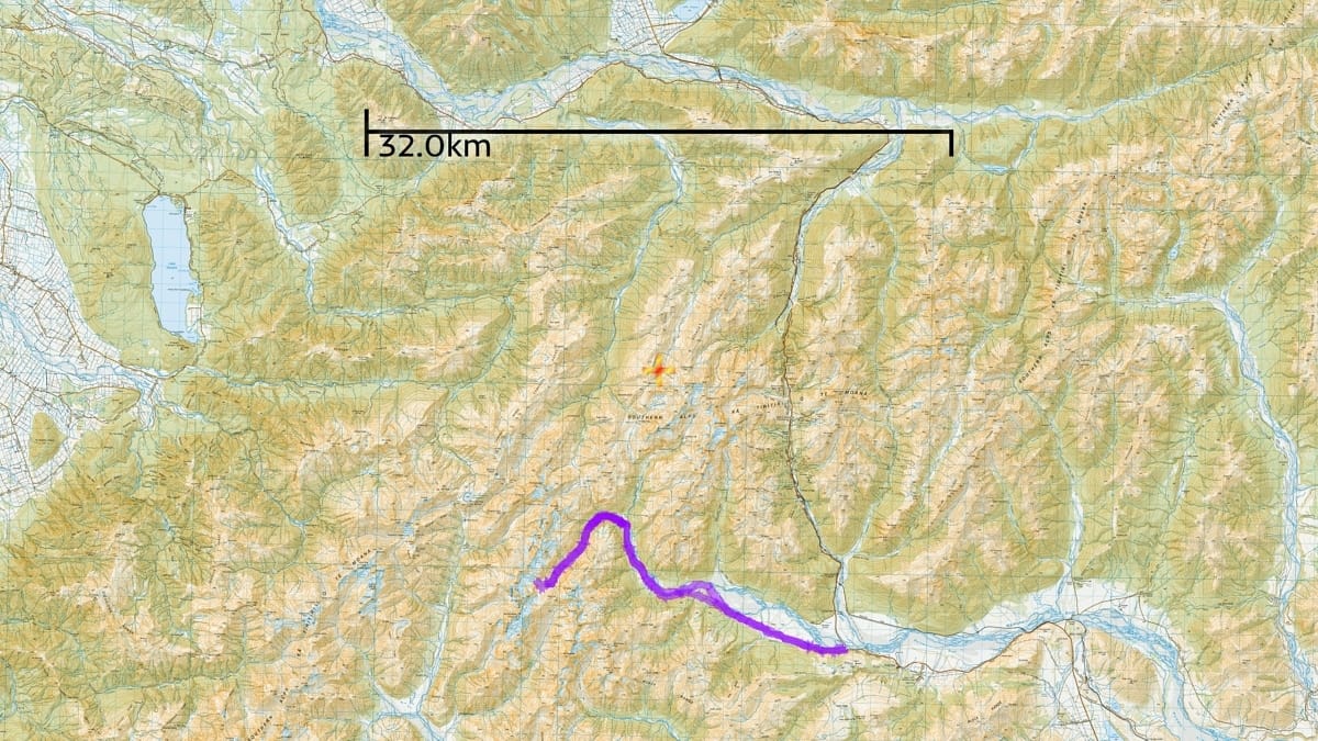
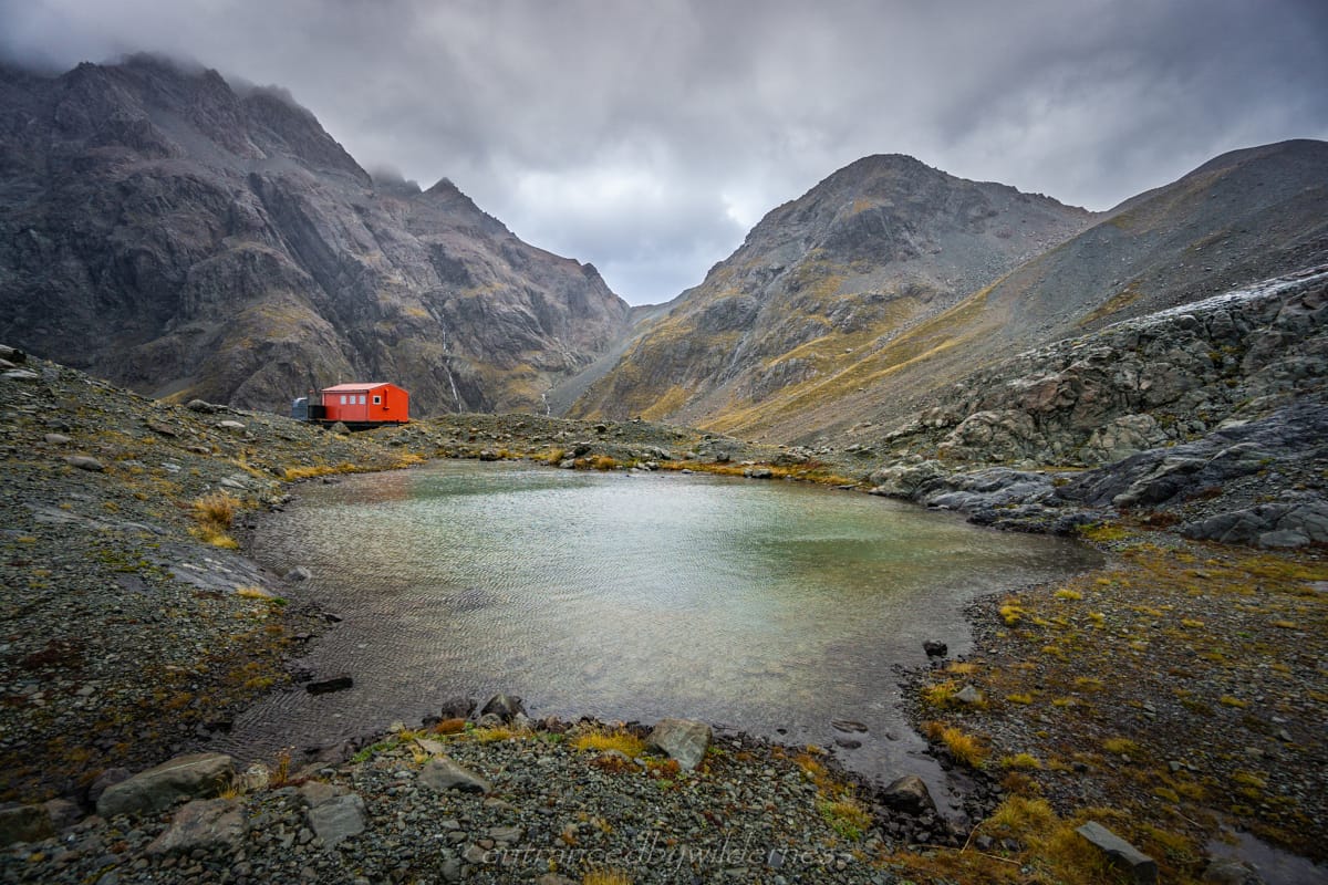
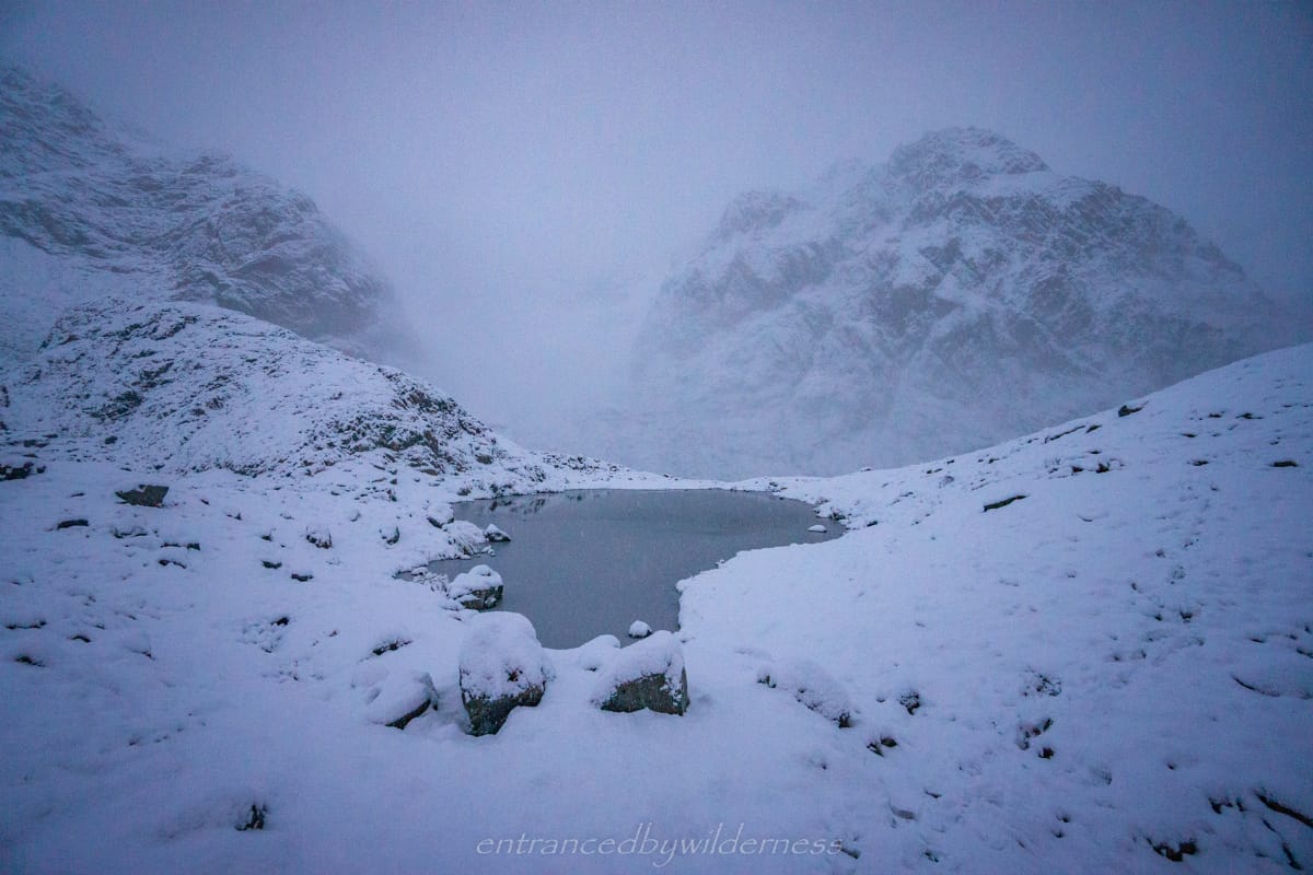
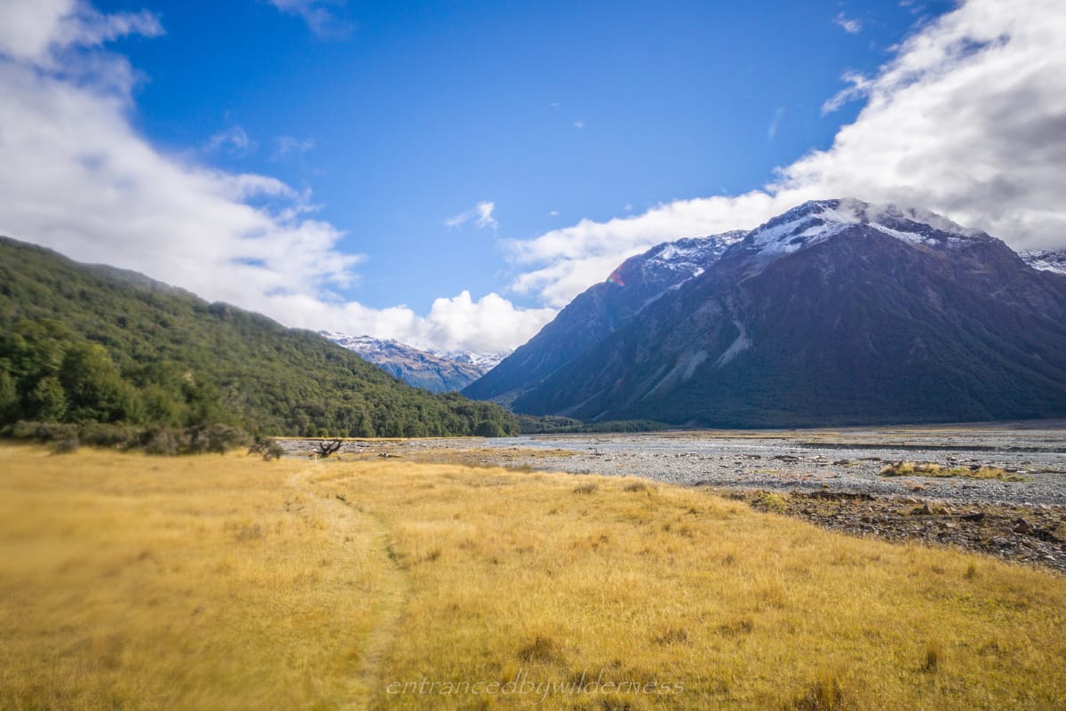
The Barker Hut Route is located in the South-West side of Arthur’s Pass National Park just off the Shaler Range, perched at about 1566m between Mt Murchison (the tallest peak in the National Park), Mt Wakeman, Mt Harper and Mt Davie. The hut itself is perched on a protruding bluff, overseeing the entire valley and surrounding mountains. Nearby, are two easily accessible glaciers to walk to – White and Marmaduke Dixon glaciers, with a good view of Cahill glacier too. The hike to Barker Hut shares part of the more famous ‘Three Passes’ hike route.
Fees
It is not a DOC hut, but a serviced alpine hut owned by the Canterbury Mountaineering Club and costs $8 per night via deposit slips in the hut or via membership (lock box present for money).
Getting There
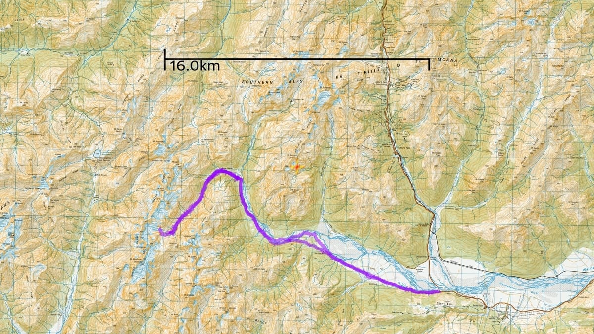
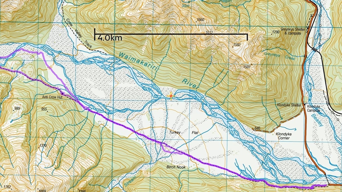
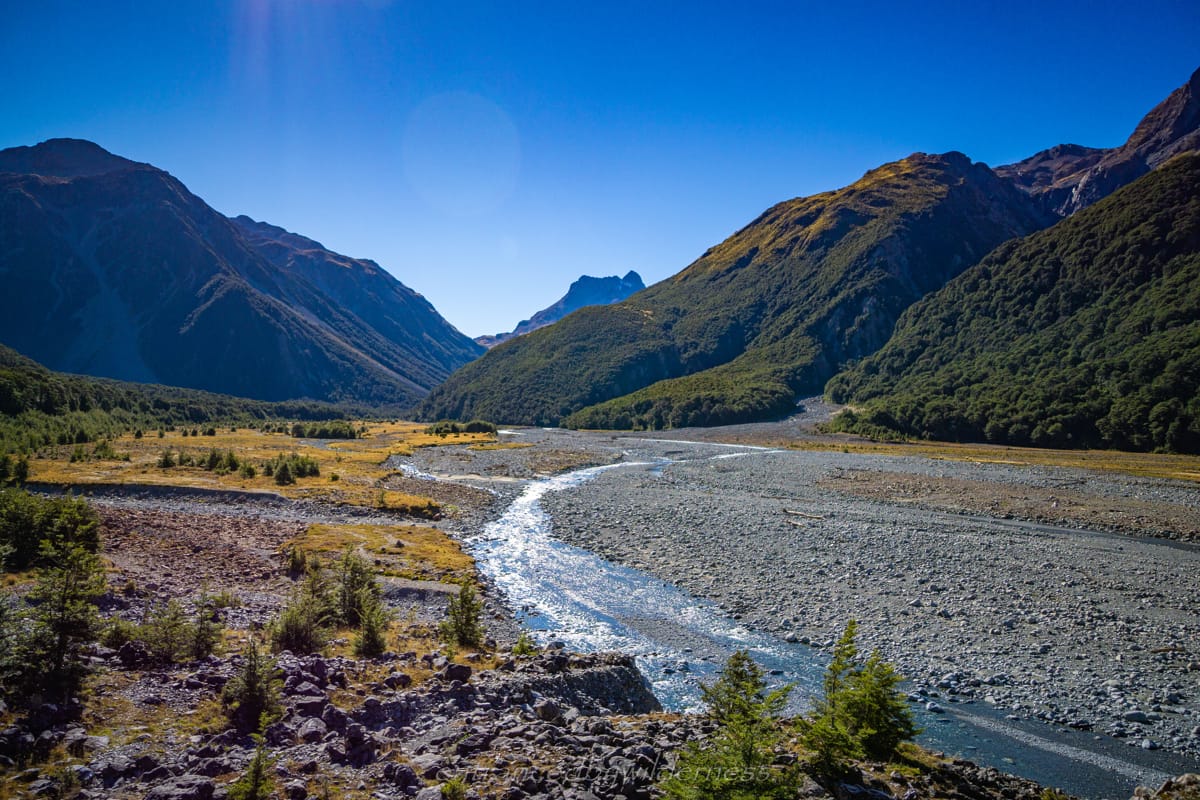
Accessing Barker Hut is most directly done via the Waimakariri River, but can also be accessed (more challengingly) via the feeder streams to the Wilberforce River. To access via the Waimakariri River, there are two car park locations: 1) O’Malley’s Track Carpark – Located directly at the east side of the Waimakariri Bridge near Klondyke Corner, and 2) at Klondyke Corner itself (first left turn after bridge). Parking at Klondyke Corner requires stream crossings, whereas at O’Malley’s, they are optional as there is a ‘high river’ rough track.
From either car park, you essentially follow the Waimakariri River upstream until it meets the White River where Carrington Hut is.
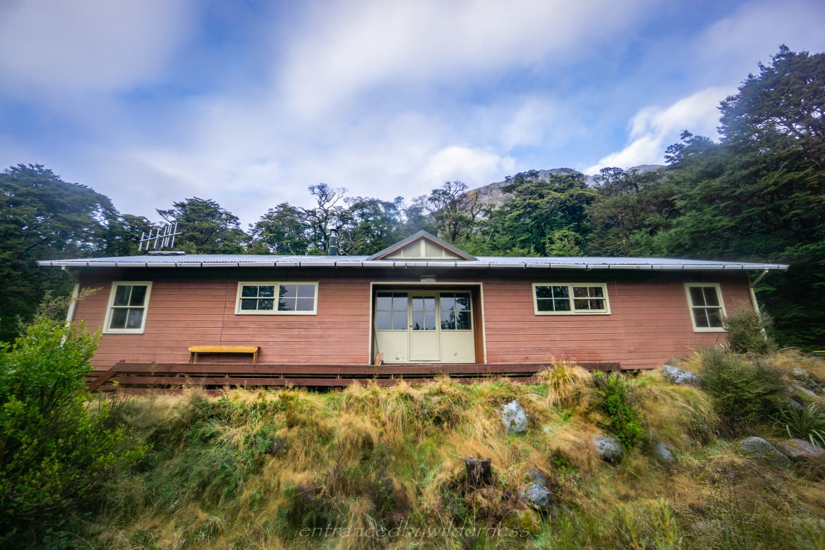
It is advised to stay in Carrington Hut (DOC serviced hut $15/night) prior to setting out for Barker Hut. The walking times are reasonably accurate, but conditions will vary depending on if you walk via the stream bed or take the trail to Carrington Hut. Anti-Crow Hut (DOC standard hut $5/night) is a second option for late starters.
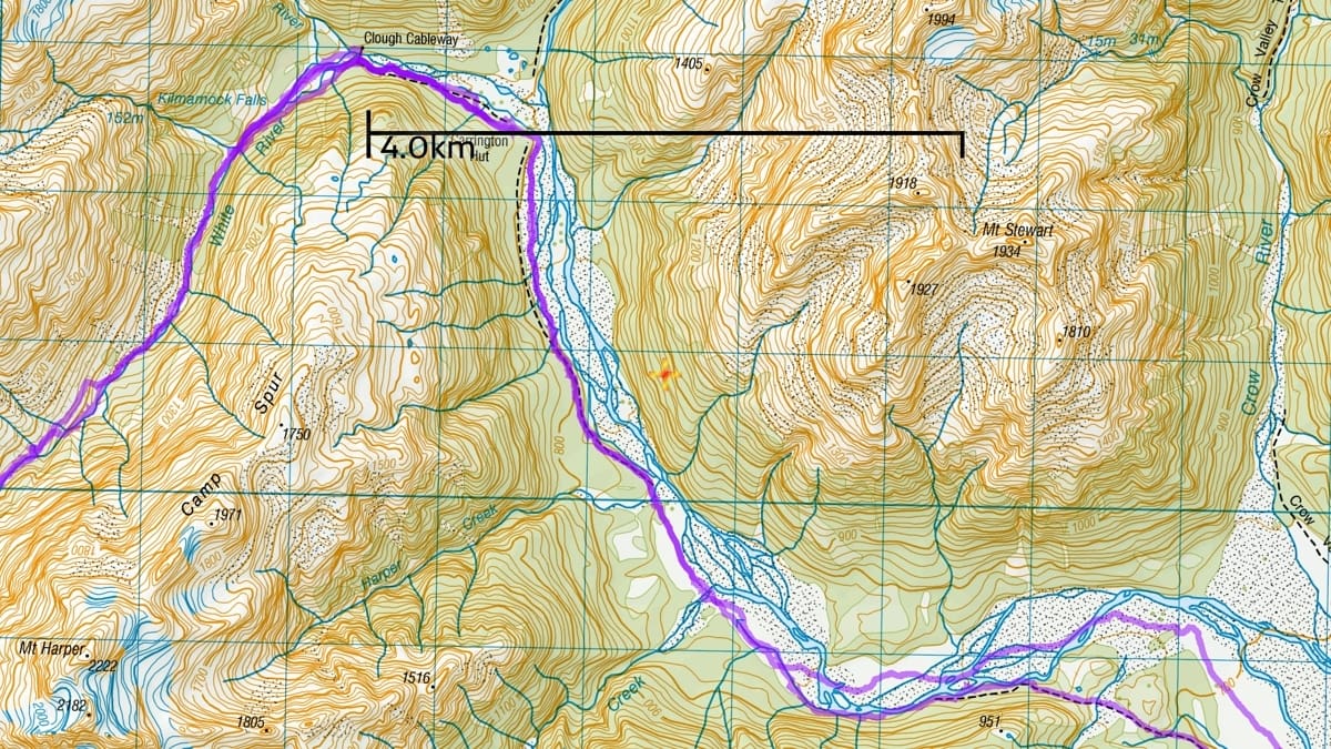
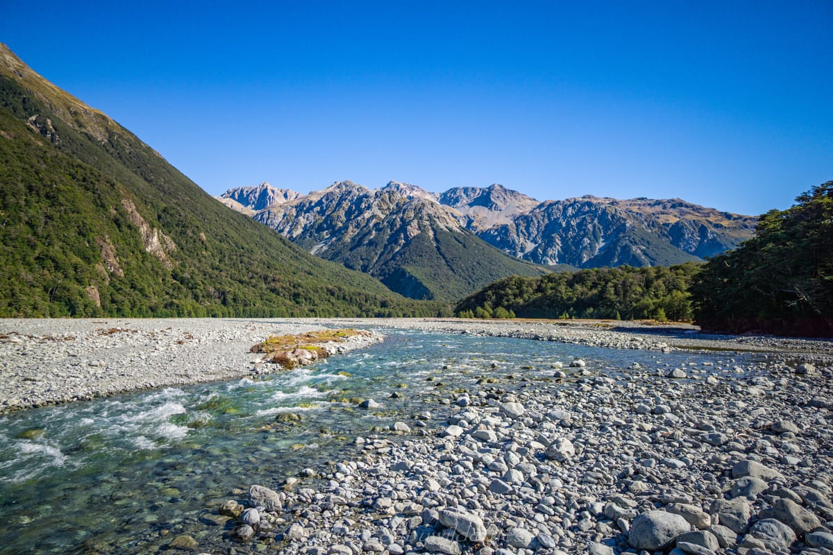
From Carrington Hut, you then venture up the White River the entire distance until the valley end to the hut.
Time and Length
In total, the Barker Hut Route will take anywhere between 9-12 hours, and is roughly 45-50km return depending on your choices and if you do any side trips.
Difficulty
There are some marked forest sections intermittently between O’Malley’s carpark and Carrington Hut, and the final section on the Barker Hut Route is fairly easy to follow with rock cairns. However, most of the time you are making your own way via the riverbed with no obvious trail.
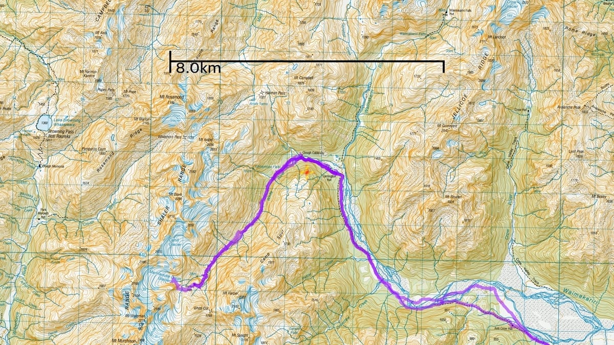
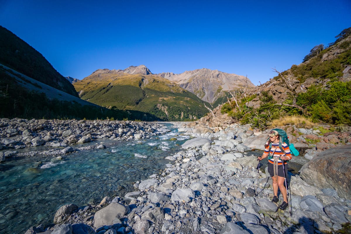
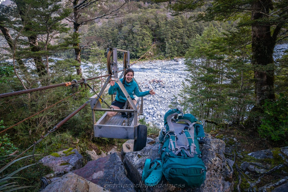
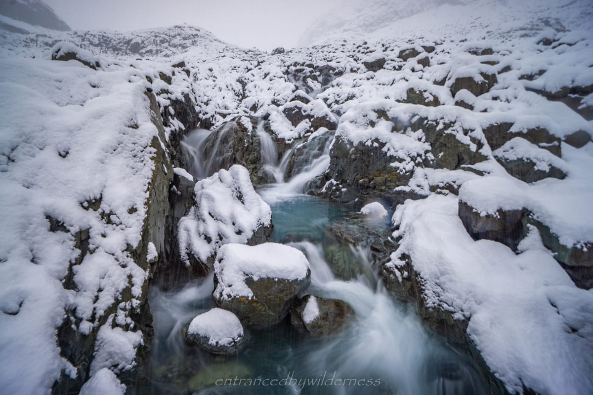
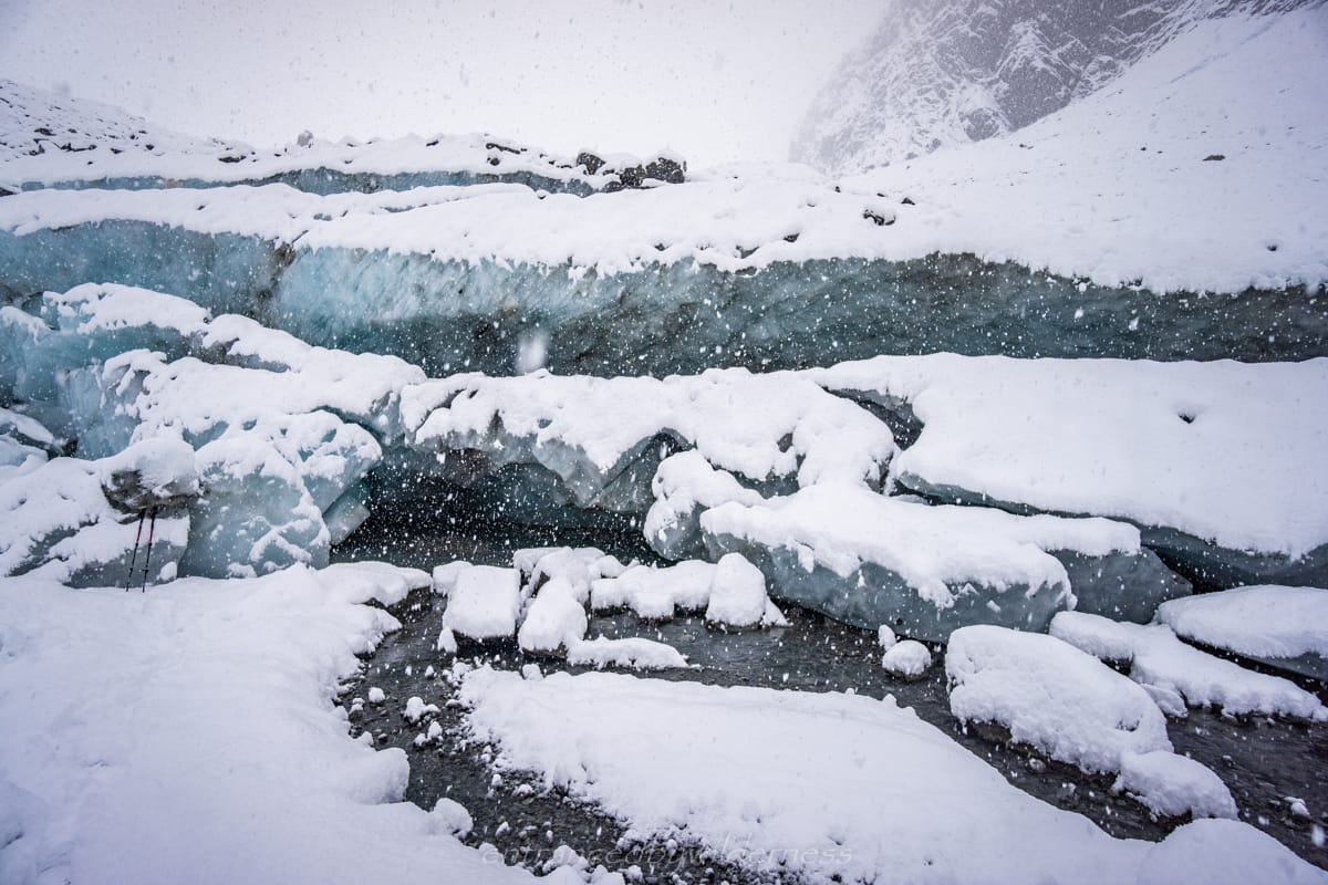
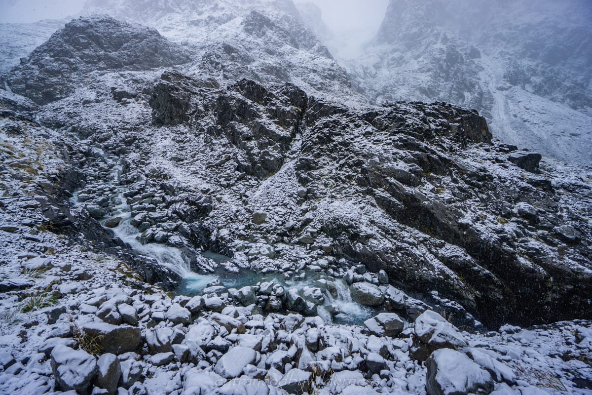
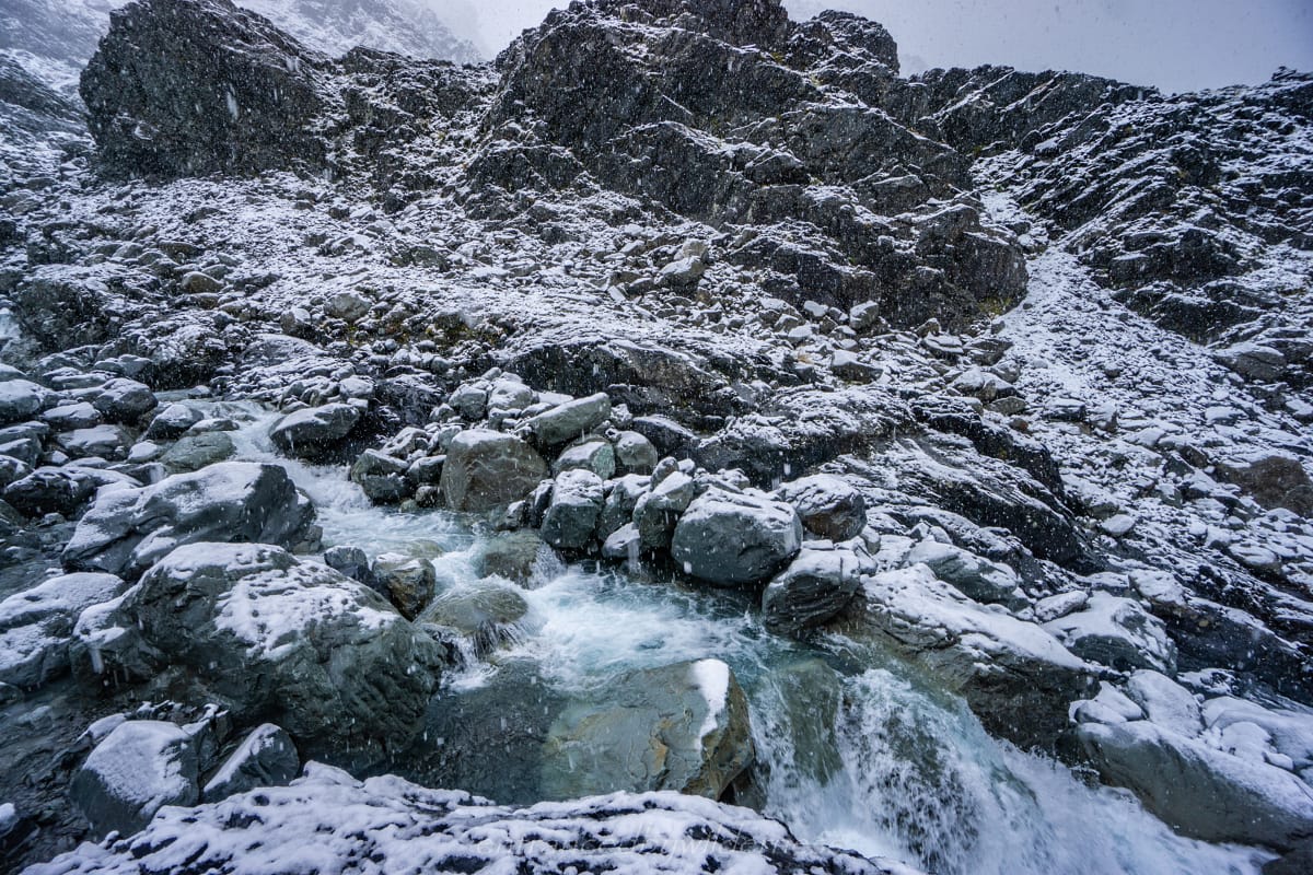
It should be noted that there is quite a few stream crossings. Both rivers are relatively easy to cross when low, but they will rise fast in rain. The most concerning is the White and Marmaduke Dixon Glacier run-off stream. This stream has limited crossing sections with a fast flow. However, its narrow and should be easy to cross in most cases. There were multiple entries in the hut book about people being stuck for a few days at the hut with ongoing rain because of this stream. The Clough Cableway is in good condition and will allow access across the White River if high (although you still need to cross the smaller Taipoiti River regardless).
Overall, this hike is moderate level in experience. It is suitable for anyone with navigation skills, river crossing safety skills (in dire weather), and an ability to hike without a trail.
The Hike on the Barker Hut Route
Day 1 – O’Malley’s Trailhead to Carrington Hut
After driving from Queenstown to Arthur’s Pass overnight (some 7.5 hours), I arrived at O’Malley’s trailhead and met up with Mel at 7am. I met Mel 4 months before on a hike in this region, and we agreed to do a multi-day hike together one day. Timing worked for this trip with work breaks around Easter, so we planned the dates in advance.
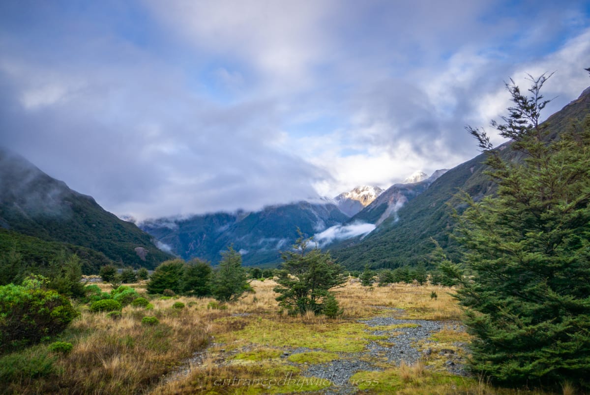
Alas, the weather was not ideal, but that didn’t stop us! The forecast on the first day was great, but a storm cell and rain (with potential snow) followed up on the second and third days. We decided to change our original plans from hiking the Three Passes route to just doing something with an easier exit point. Either way, we’d hike to Carrington Hut, so we set off there.
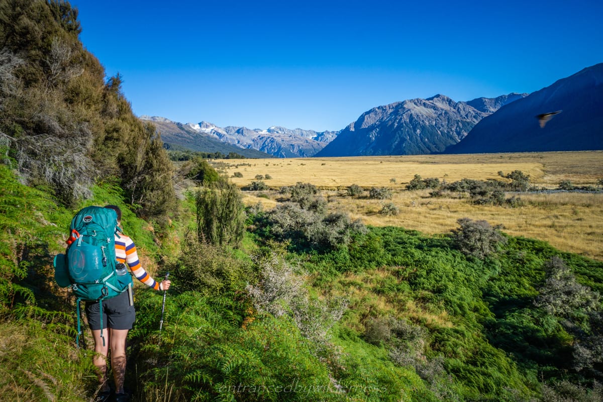
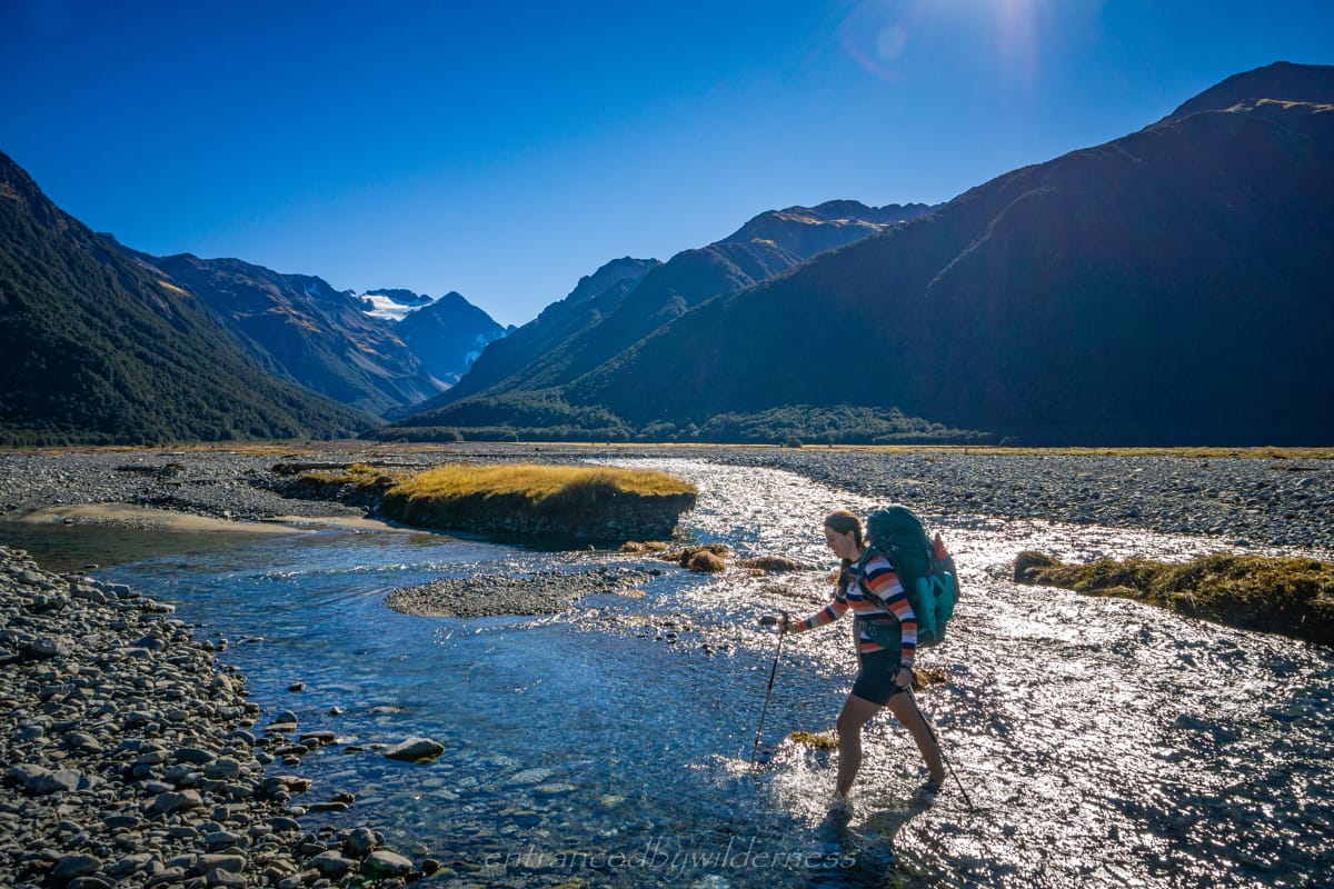
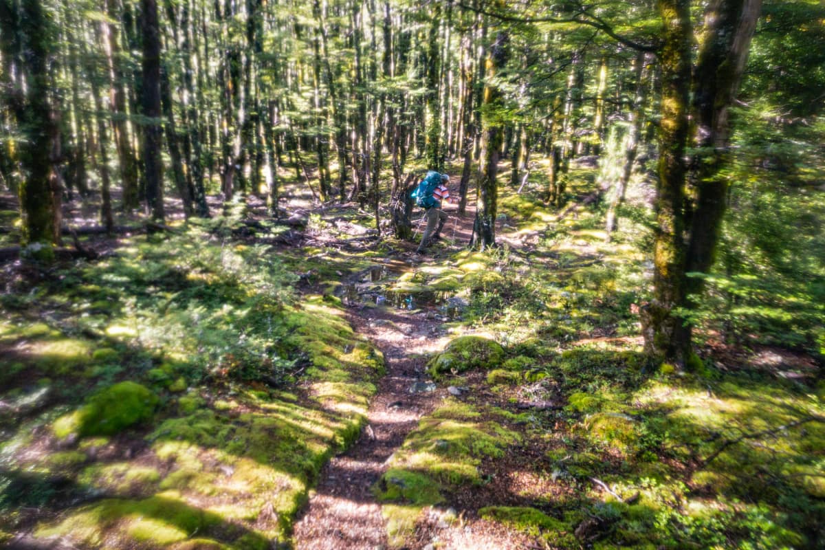
O’Malley’s track was good at first but it gets rougher further along as it hugs the forested ridge above the river plain. We decided to just follow the Waimakariri River and cross it several times, as it was quite low. The scenery here was nice as it wasn’t rural as hikes often start out as in New Zealand.

We only really crossed the river at two points, otherwise it was mainly stepping over the braided river sections to the sides.
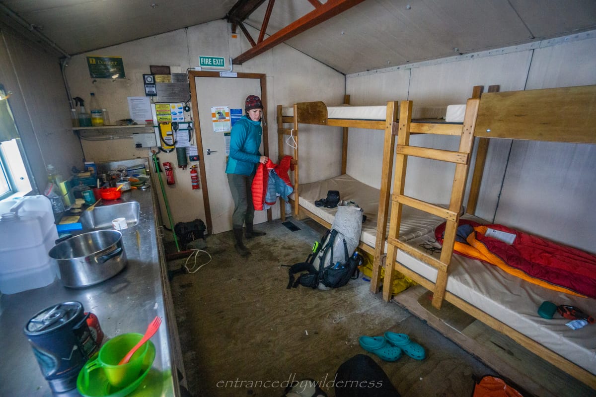
Carrington Hut
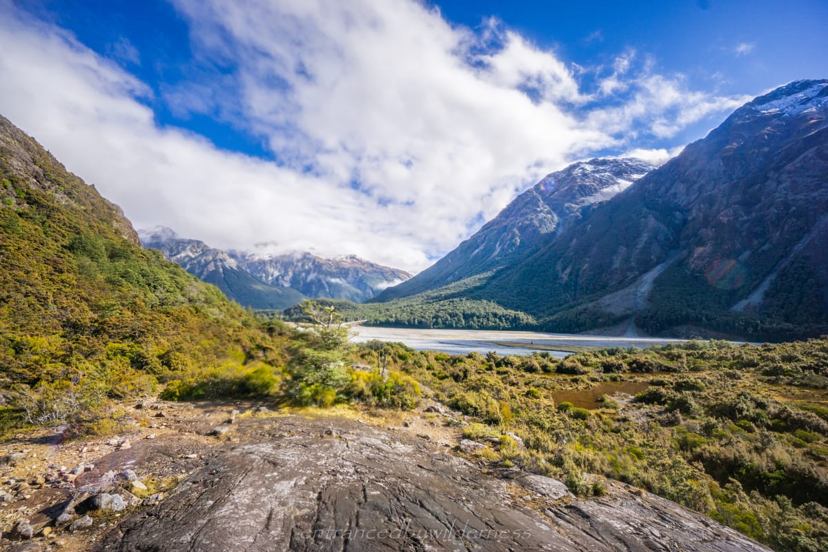
Carrington Hut was reached after roughly 5 hours. Being a large serviced hut, it wasn’t anything special, but it is located at a vital junction to go deeper into the backcountry. The plans were changed at the hut, and we wanted to aim for either Waimakariri Falls Hut, or Barker Hut. Deciding on the latter, Barker Hut looked like an awesome vantage point to see the glaciers. Being only 2:30pm at this point, we decided to have a go at going straight to Barker Hut with a turn around time in case we didn’t make it.
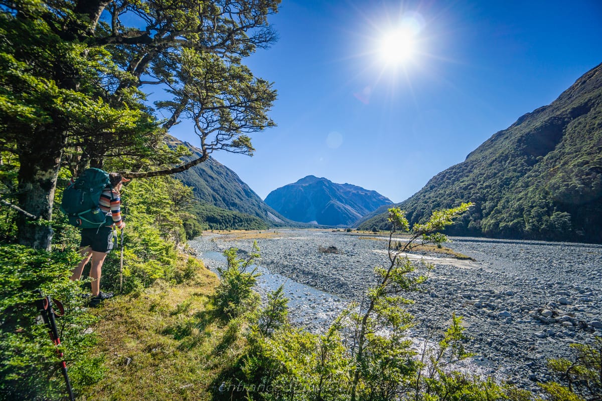
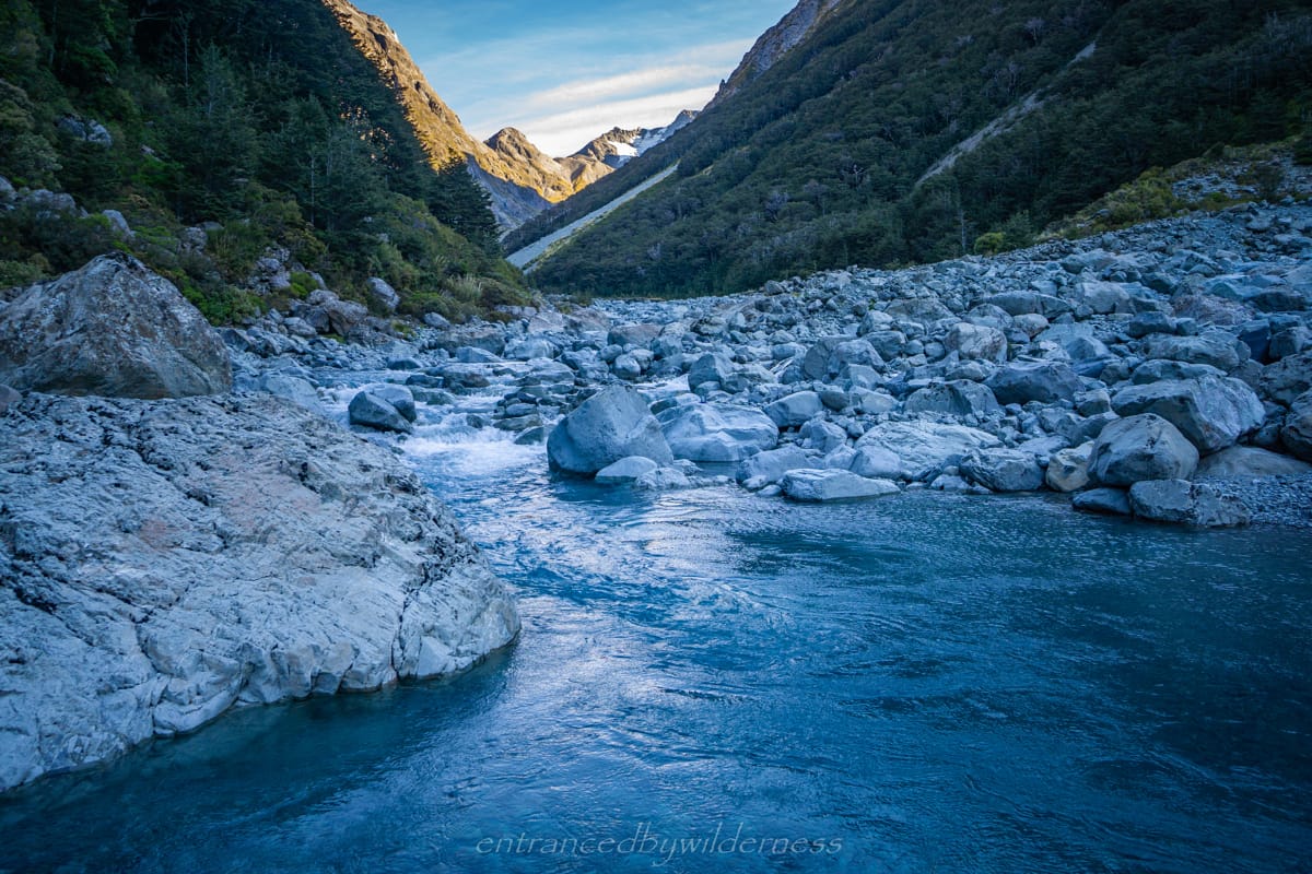
After leaving Carrington Hut, we needed to follow the White River upstream. The best way to travel was not obvious, but knowing that we only needed to follow the White River, it was fairly obvious.

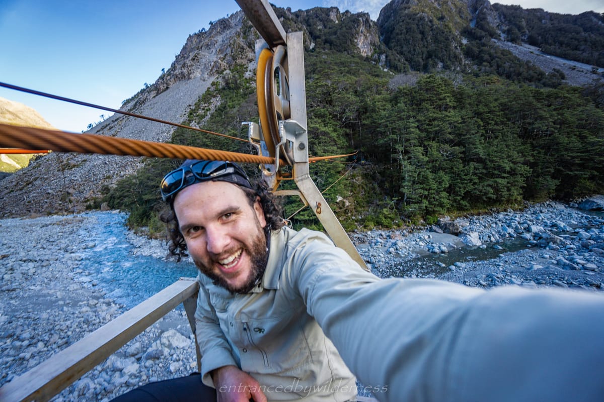
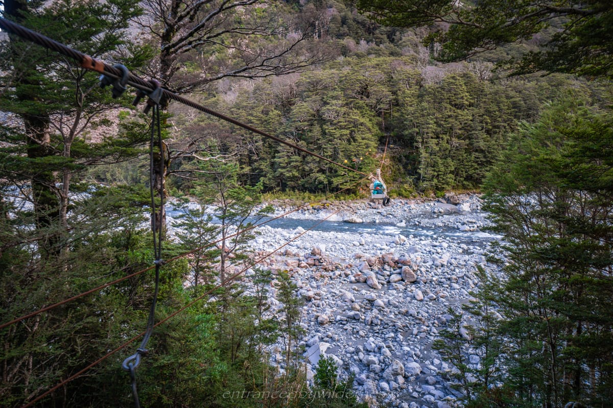
Clough Cableway
Clough Cableway is not far away, and a pulley and wheel system to carry people across the White River if it was high. We couldn’t resist having a go of it. It was pretty fun!
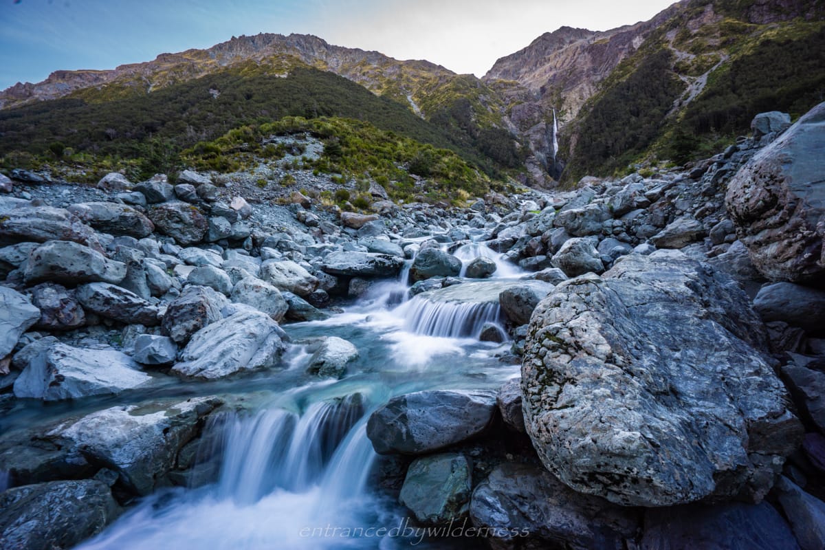
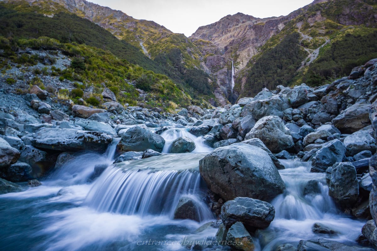
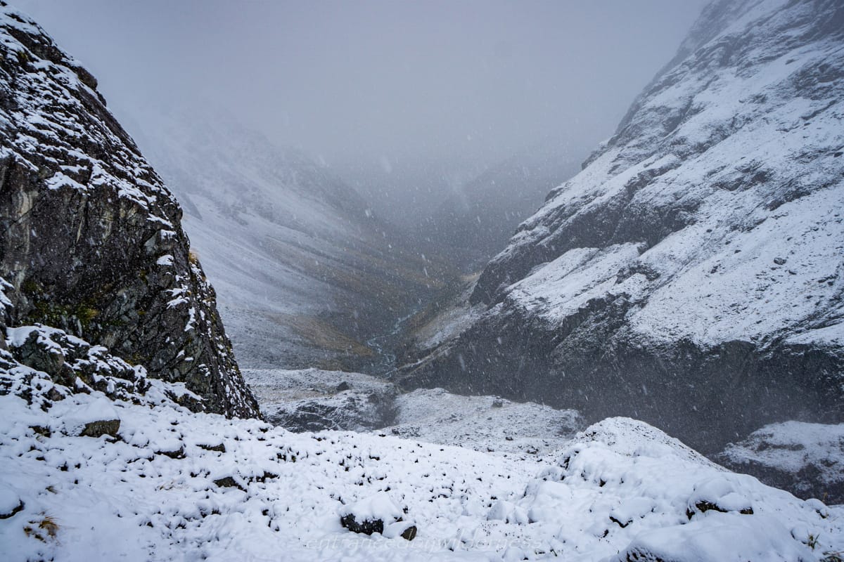
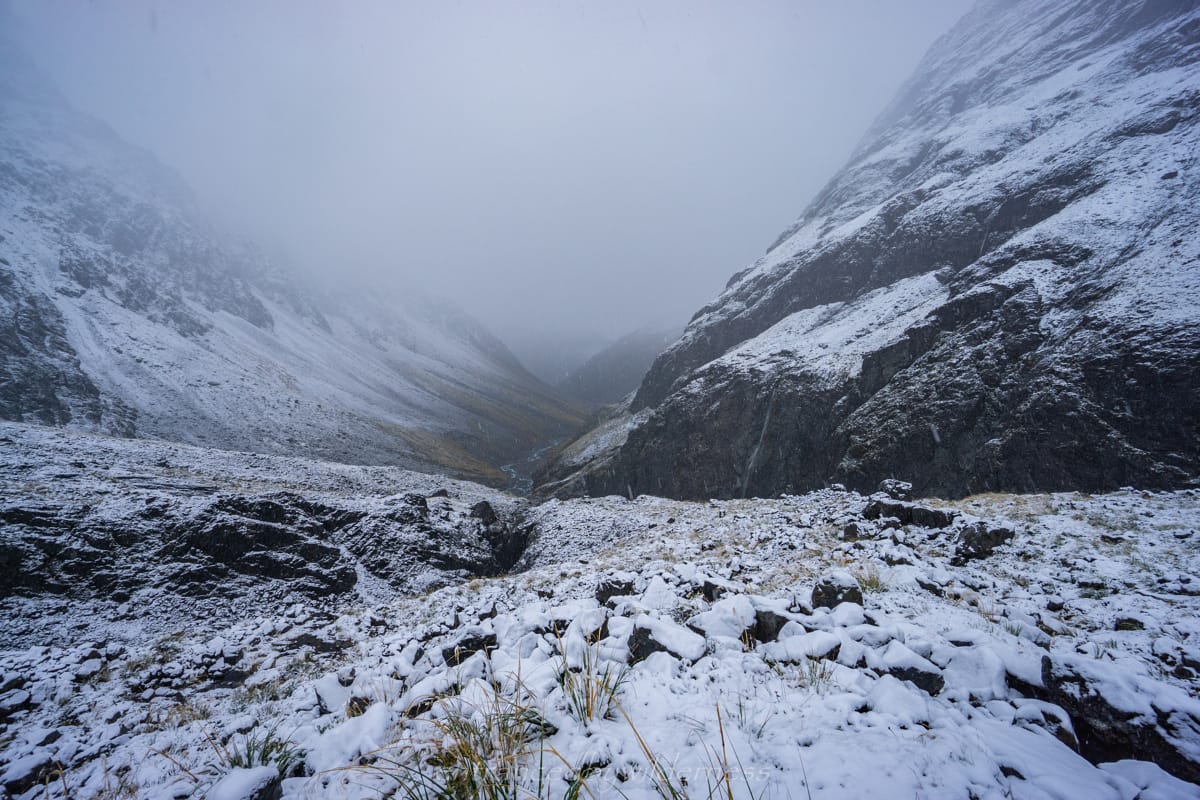
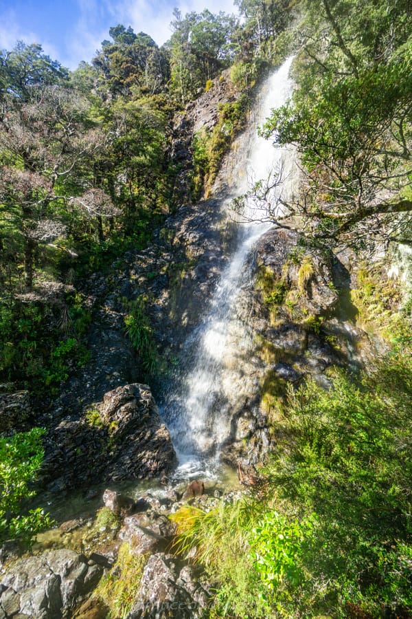
We ended up making it where Kilmarnock Falls is seen from the White River and decided to turn back as we were running short of daylight hours and saw the route is quite slow going. The Falls looked great, but is largely obscured at the lower levels, and you’d need to hike up to it for better viewing.
Upon arriving back to the hut there were about 13 people staying, quite different to our personal bets of 2 and 4 people there when we arrived!
Day 2 – Carrington Hut to Barker Hut
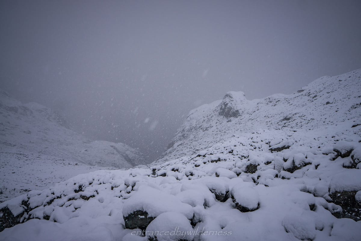
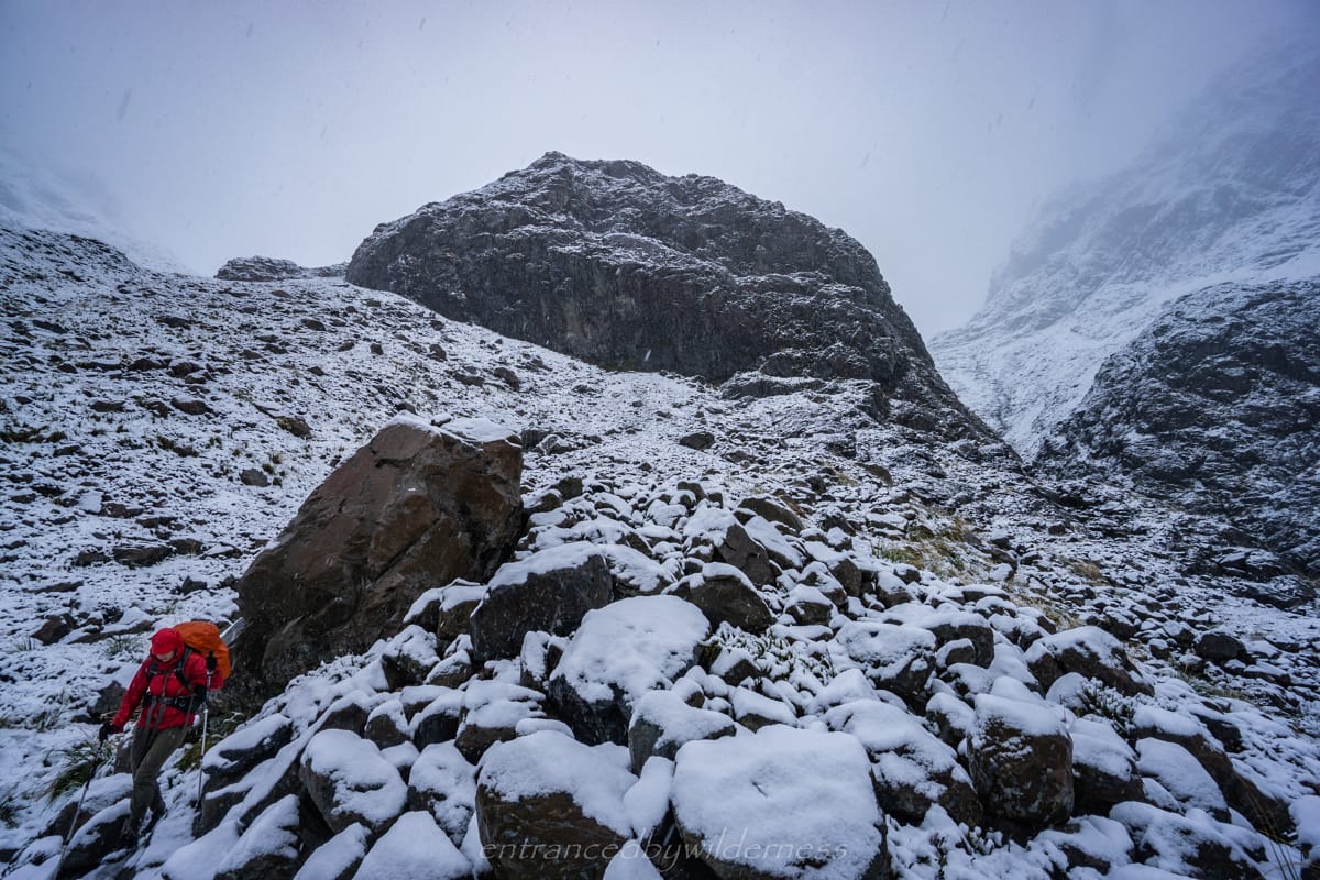
It was lightly raining in the morning. We tried to set off early, and ended up leaving around 7:30am. Heading off again the same way as the day before up the White River, a familiar scenery. We knew the best way around obstacles this time thankfully. There are several boulder falls and slips to cross, and we knew that sticking to the true left of the river was better. Sadly the rain prevented any photos this day.
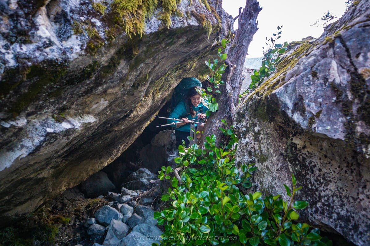
There is no real marked trail here, but rock cairns were around. To just follow the river the whole way seemed the easiest option. However, there was one point where the river was through a narrow gorge and we had to head up the scree to a poled route through vegetation. Mel definitely did not enjoy this particular climb haha!
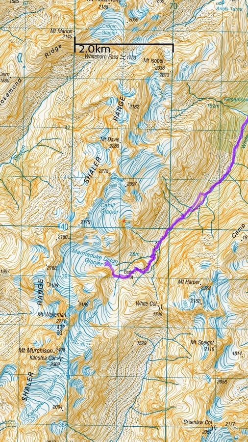
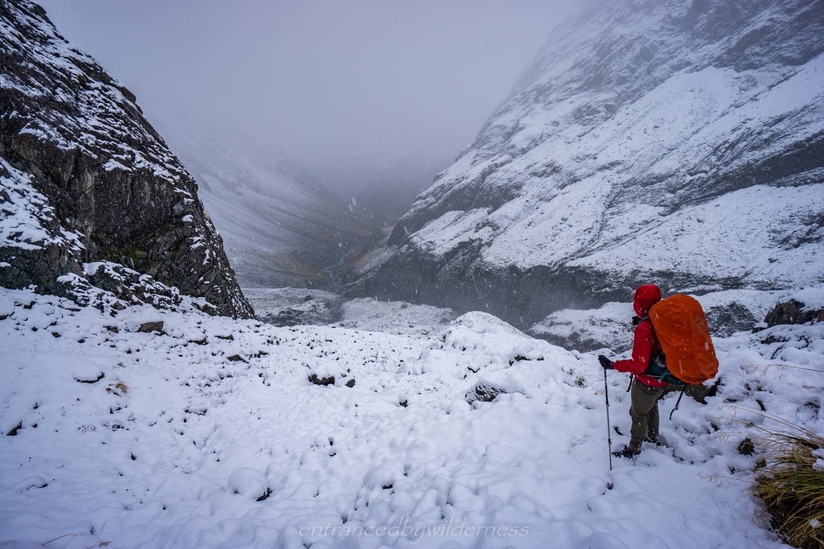
The Final Stretch
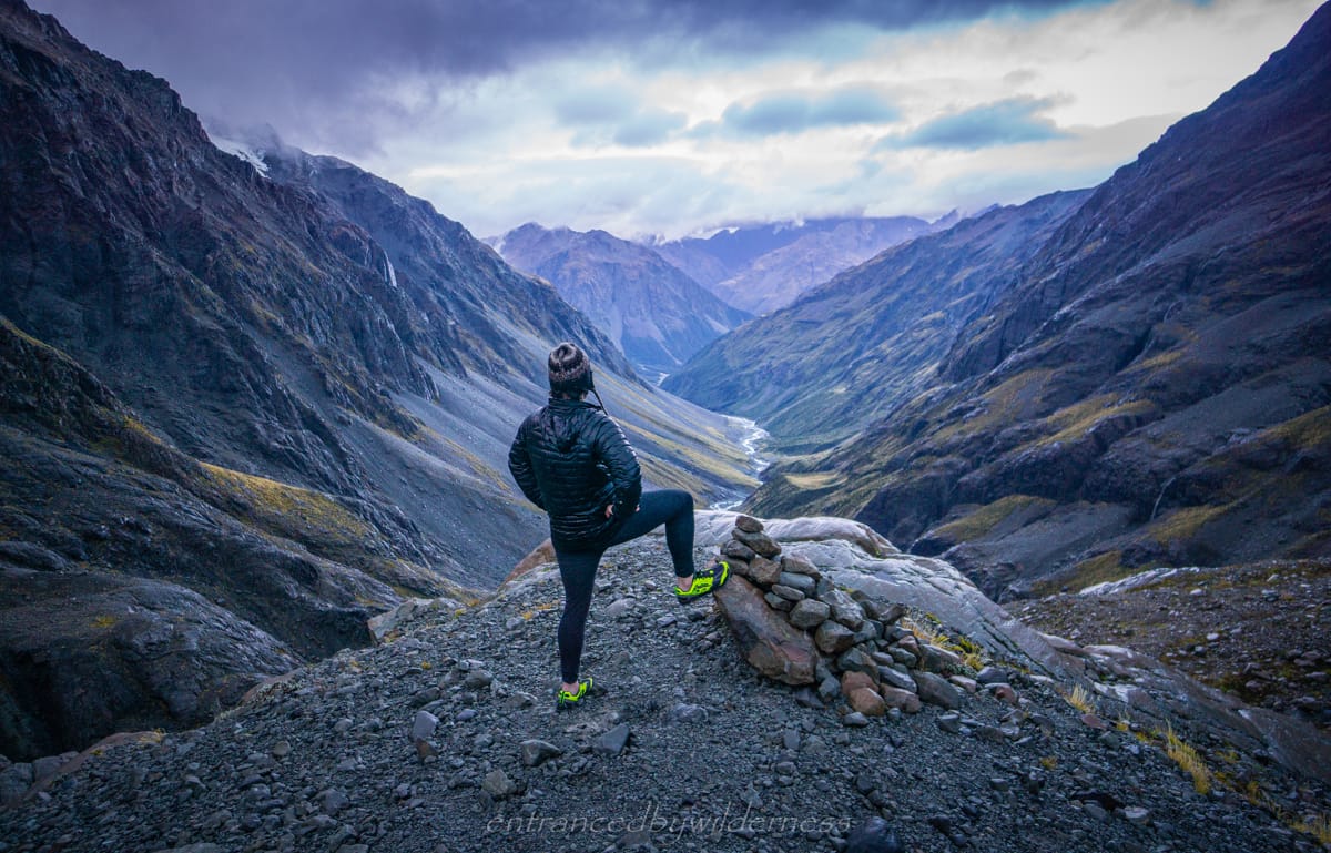
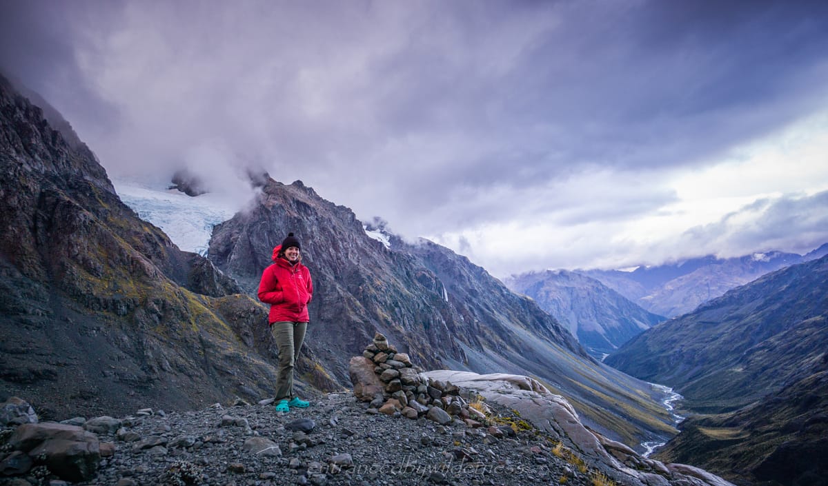
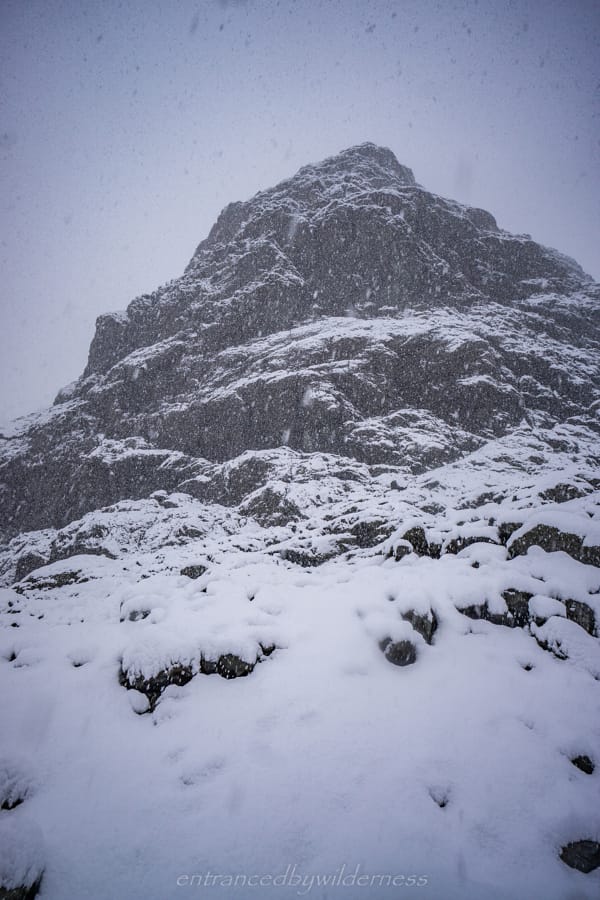
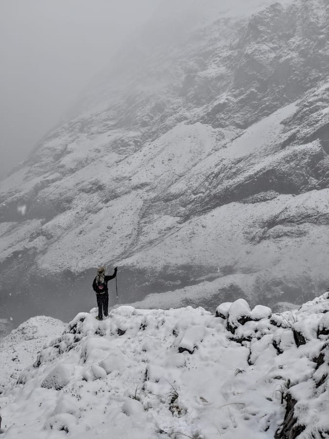
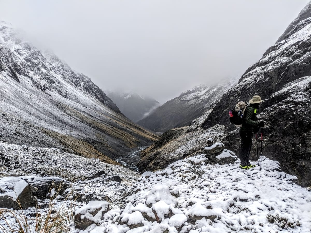
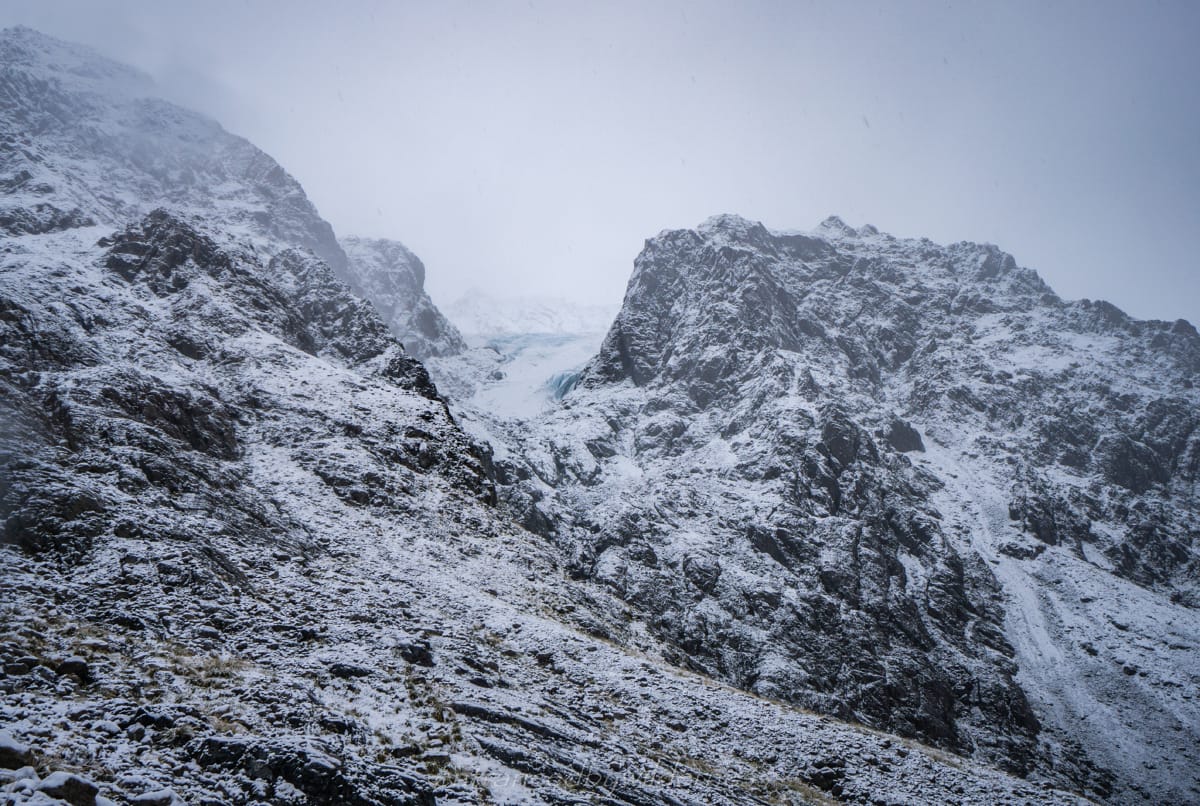
After this section, we could see Barker Hut in the distance on the rock bluff. It looked amazing! Part of White Glacier could also be seen. We ended up following the river again, despite the poles being up high still – it’s much flatter and easier. The weather was really bad by this point, as the rain picked up and the wind was cold. We both were really keen to make it to the hut as soon as possible, so we skipped any breaks! “Warmth, dry clothes and food” were the words on repeat in my head.
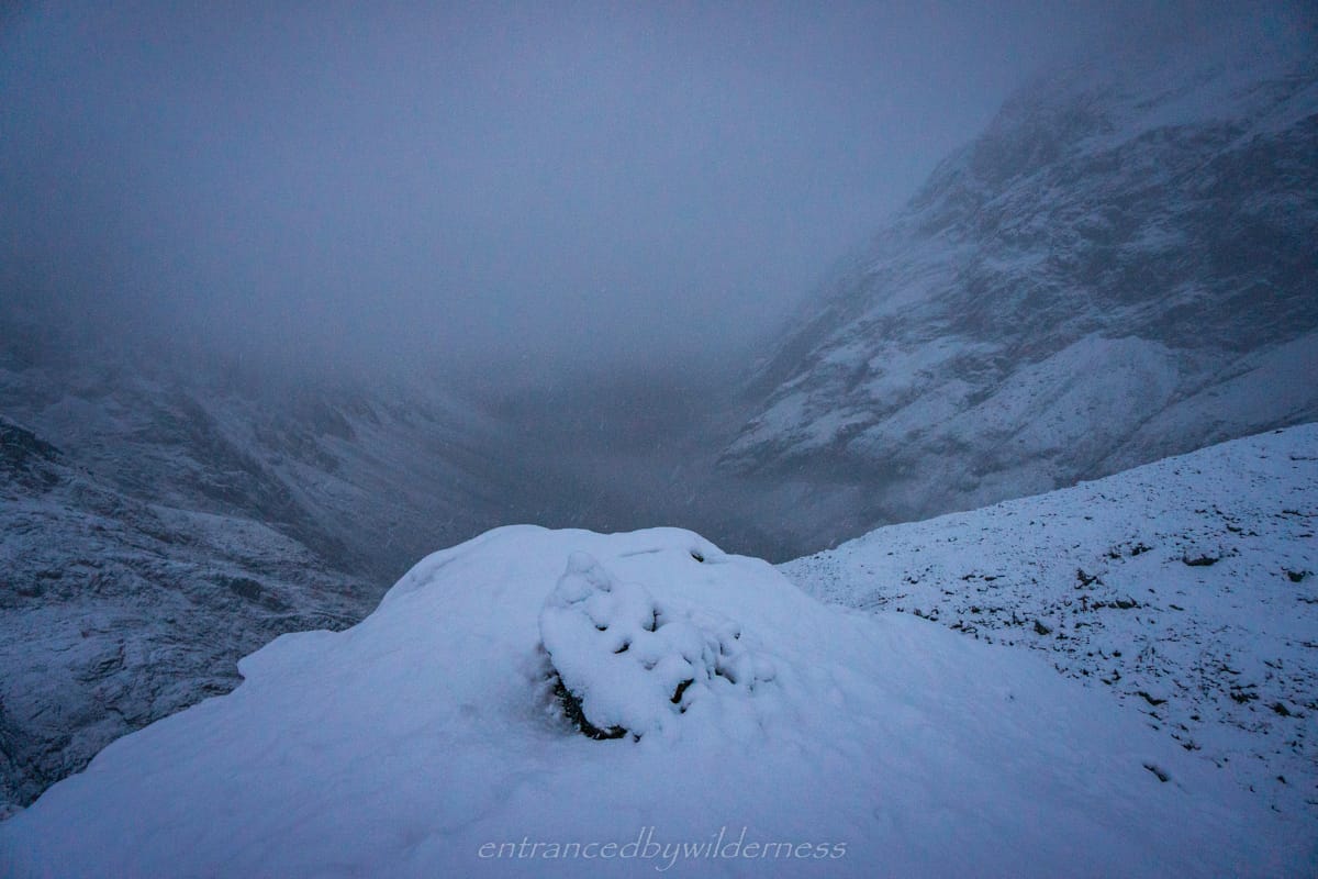
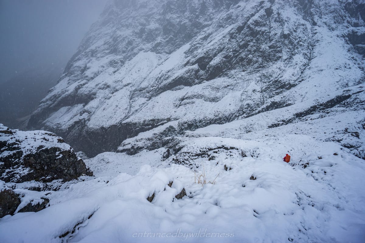
Toward the base of the rock bluff where Barker Hut is, is a gorge with the glacial run-off. Head up the vegetated ridge here to the rock cairns, as the gorge is inaccessible from the main river. There are only limited areas to cross this river as the northern side is steep. The cairned route definitely felt the best way to cross.
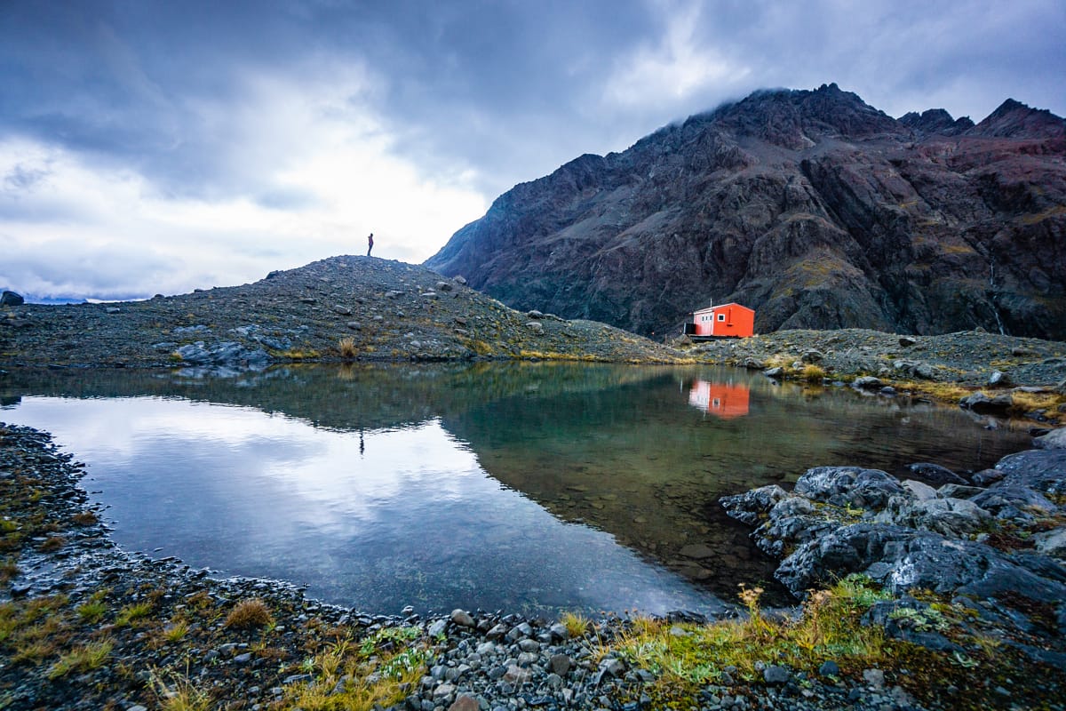
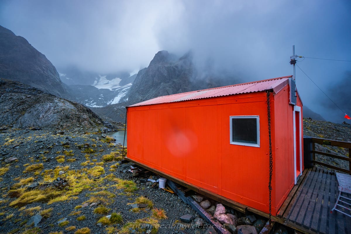
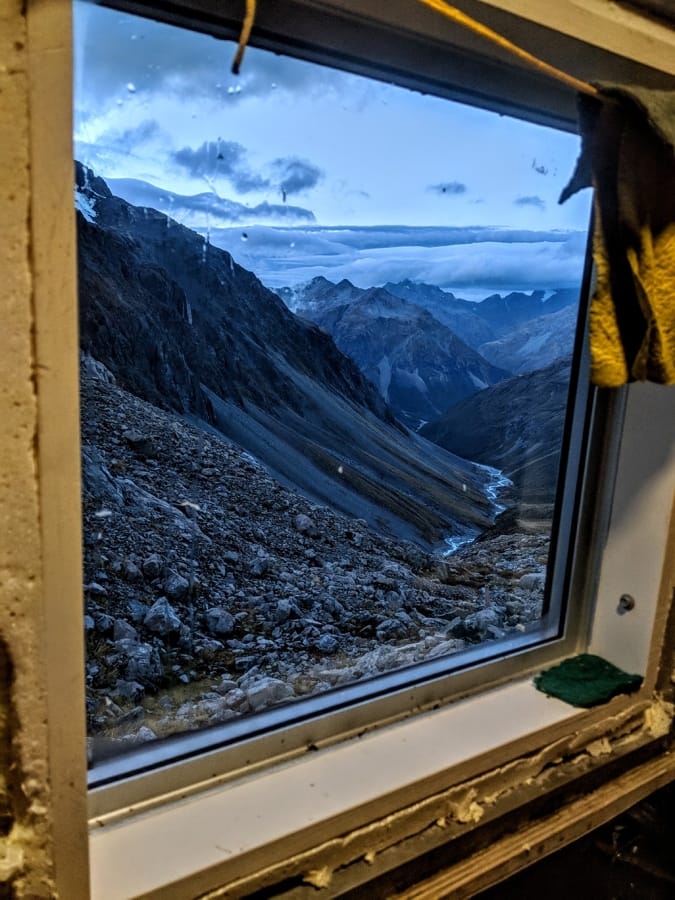
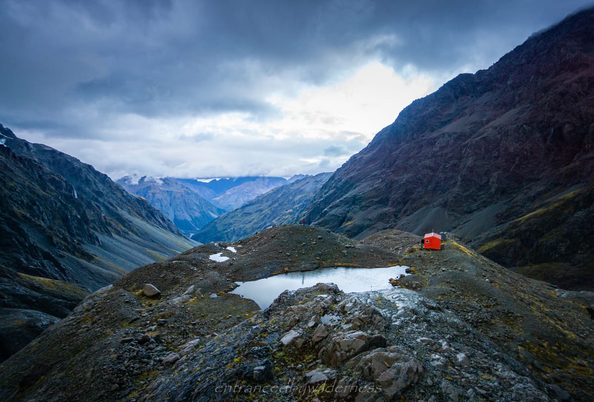
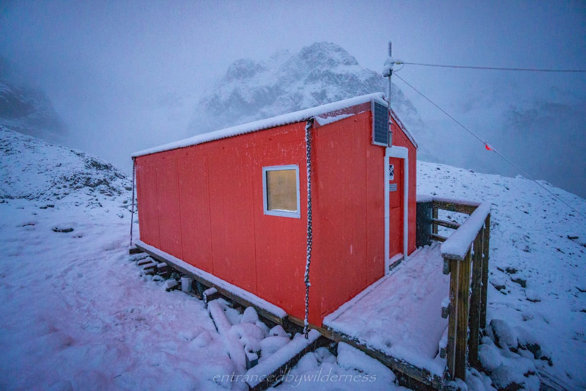
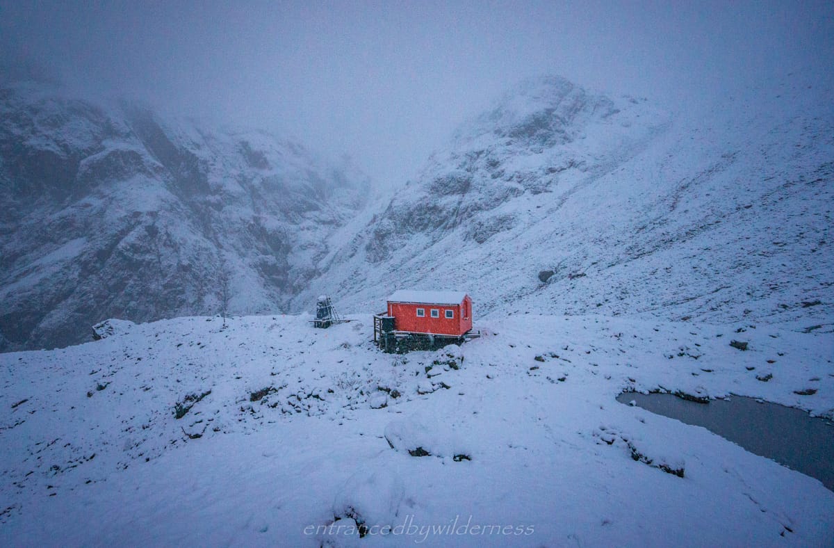
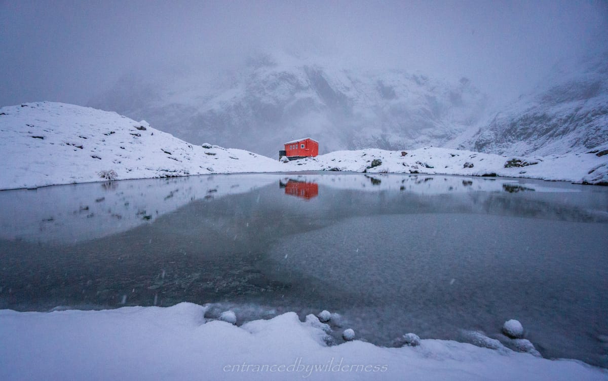
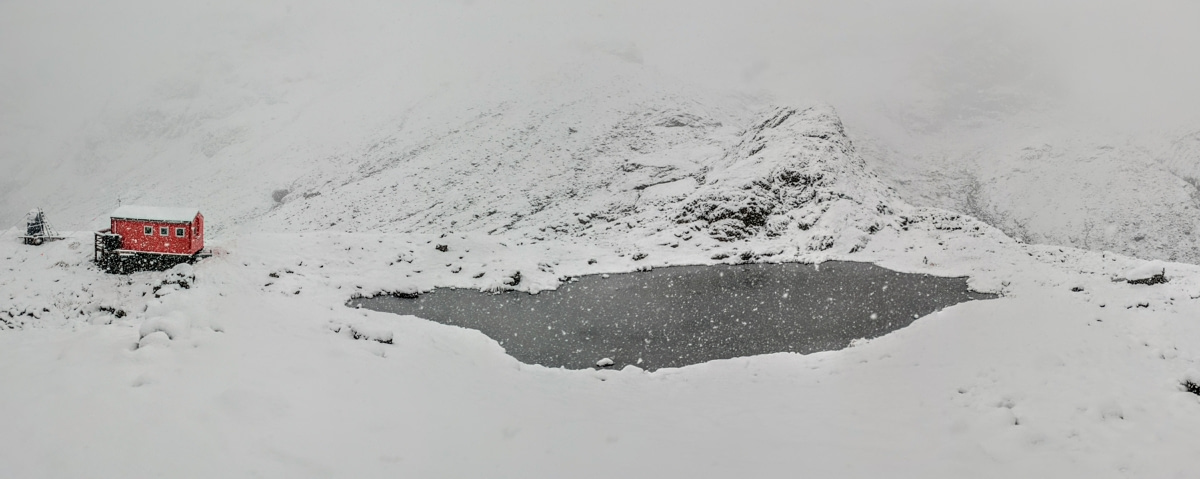
Barker Hut
After this section, the route was obvious to follow up the left side of the bluff towards Barker Hut. Arriving to the hut was instantly relieving!
Upon entering the hut, we met Chris – a volunteer handyman for the Canterbury Mountaineering Club who was doing some repairs on the hut. He offered us miso soup (the greatest thing ever at that point) and we changed into dry clothes. Chris had flown in via helicopter with tools and food. He was a funny character and we had a great time in his company. He was responsible for previously installing solar lighting, USB chargers/cords and other great features in the hut. We read out the book comments praising his work and adding ‘Thanks – from Chris‘ comments 🙂
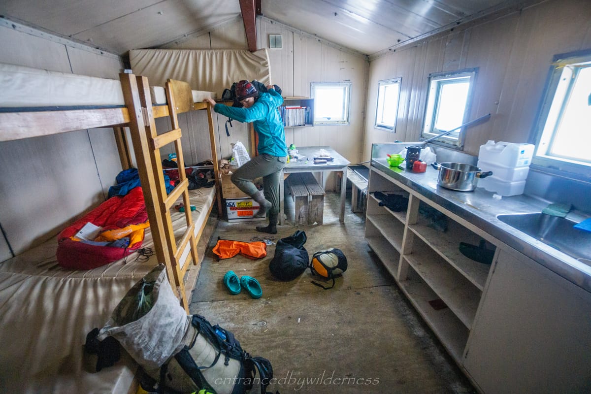
The rain and wind continued on for the rest of the day, making the hut feel safe and warm. It was truly awesome. The radio transmitter provided us with a forecast for the next days, and it appeared fairly dire with the rain continuing on beyond just the two days. After reading some of the book comments of people being trapped at the hut, we thought maybe we were also in for that. Not such a bad thing!
When the wind died off occasionally, we ventured around the hut for the epic views. It was truly an impressive location!
Day 3 – Marmaduke Dixon Glacier & Barker Hut to Carrington Hut
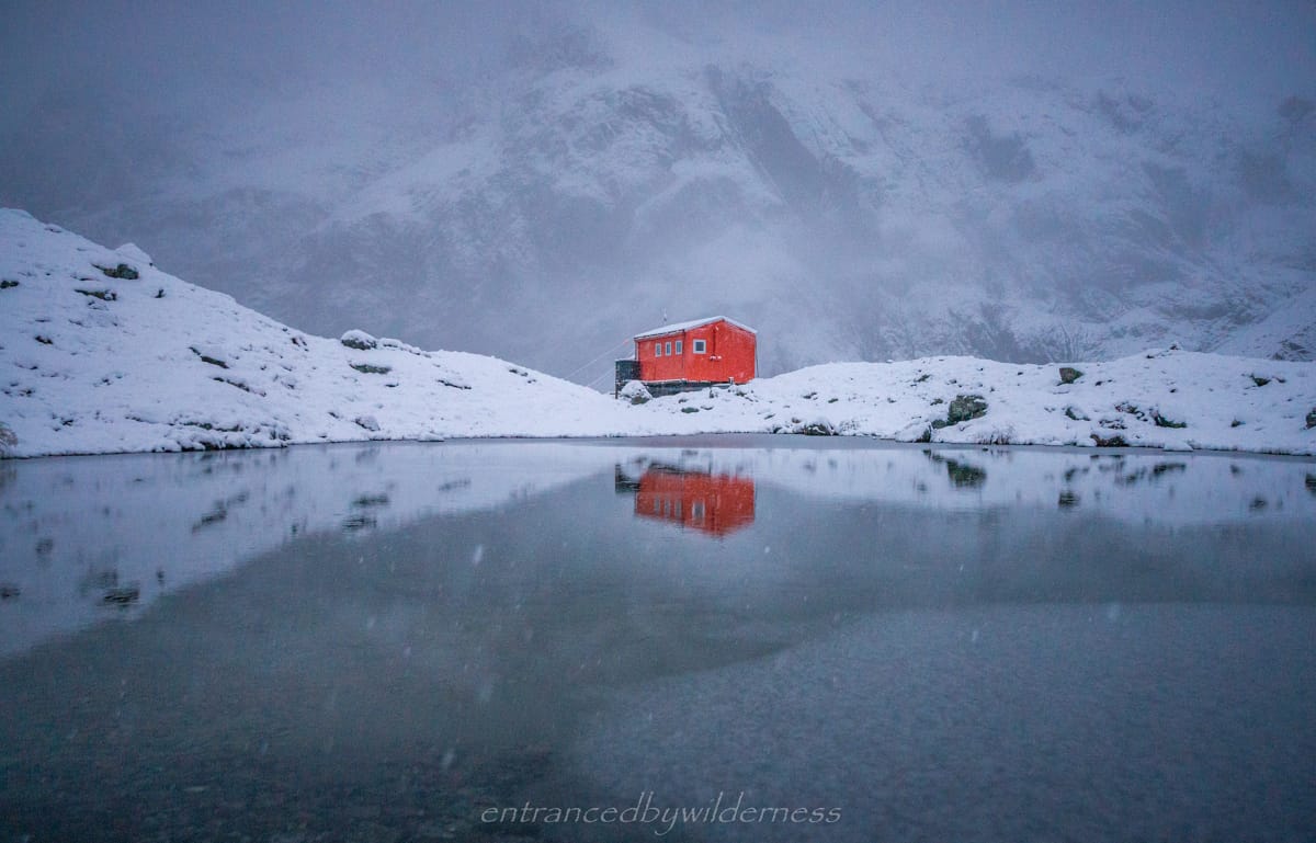
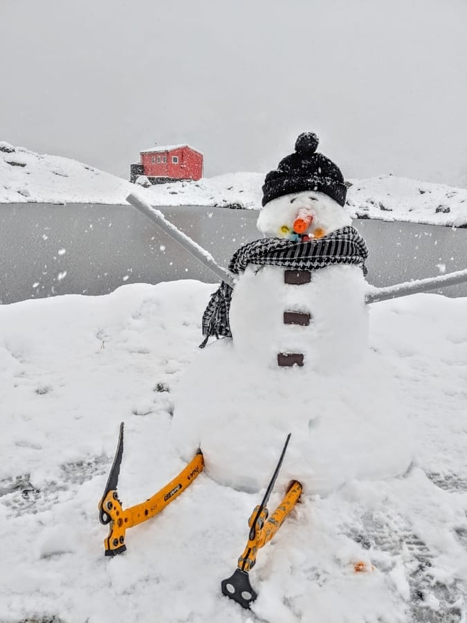
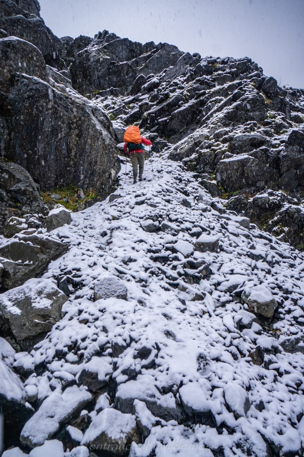
I had a fairly decent sleep, and woke up to clouds outside the hut as it was white outside. When I opened the door to the hut, I was surprised to see at least 20cm of snow outside! It was crazy! It wasn’t clouds outside after all! The best part was that the wind had died off and the snow flakes falling was very pleasant. We wandered around outside to take in the new, epic scenery.
A Short Trip
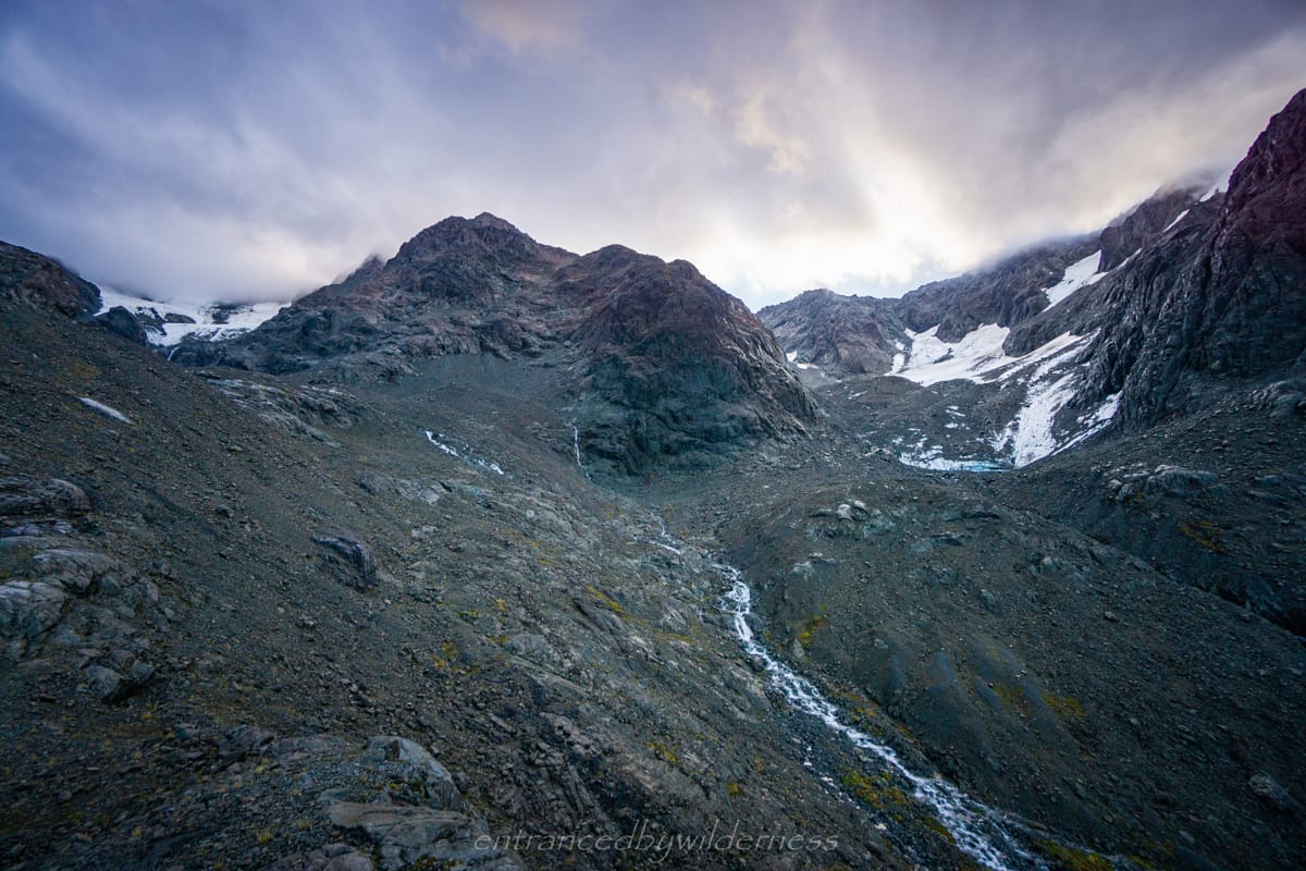
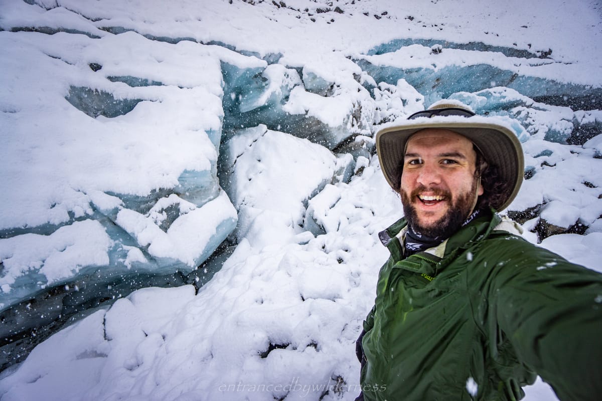
Mel had plans to build a snowman, whilst my plans were to venture over to Marmaduke Dixon Glacier, a relatively short distance away. Getting there in the snow wasn’t too bad, as the snow softened the rocky steps a little. I had to head towards the eastern bluff face of the lower section of Mt Wakeman to take the wide route around the river valley before heading straight to the terminal face of the glacier.
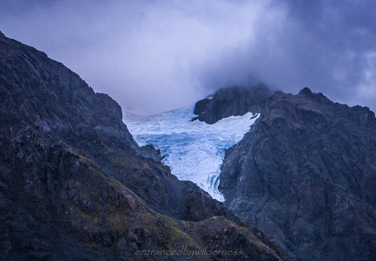
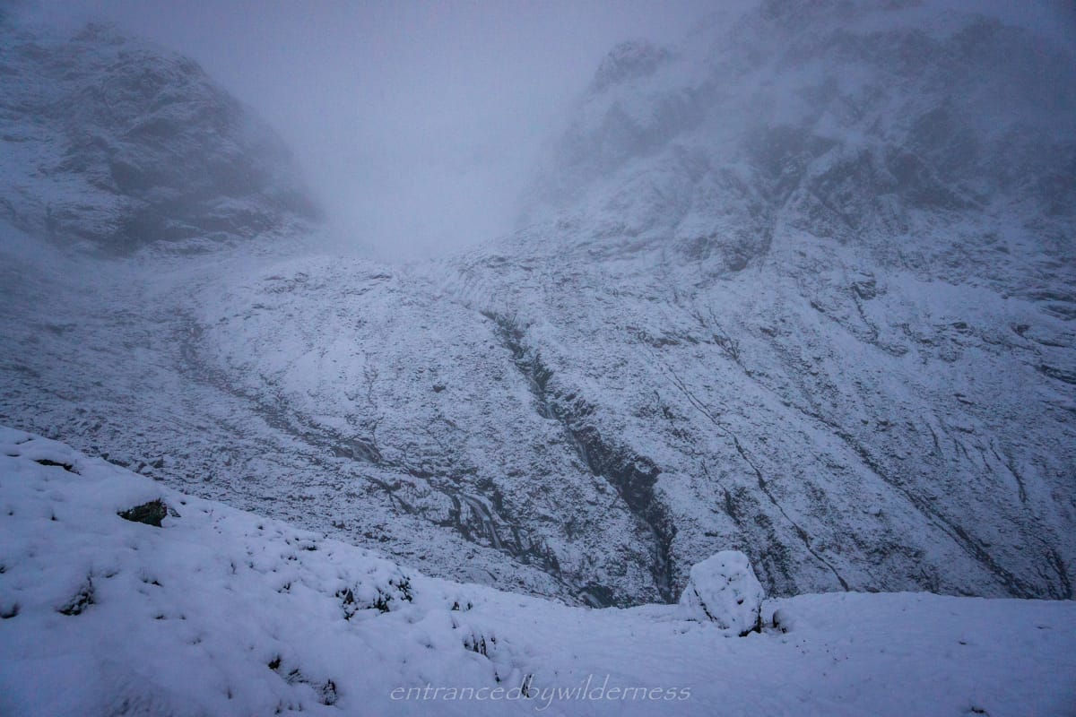
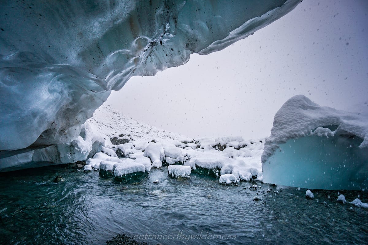
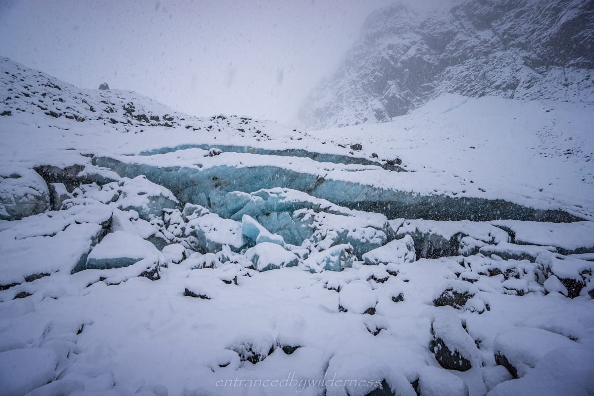
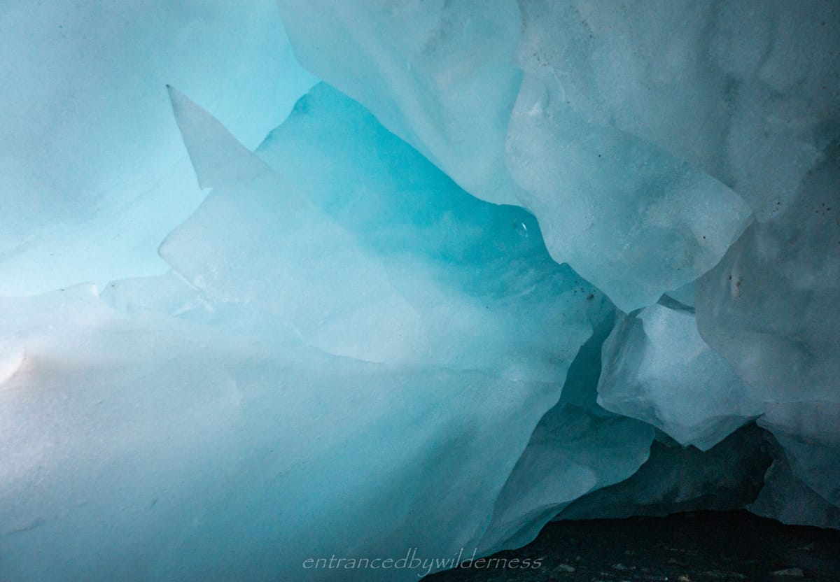
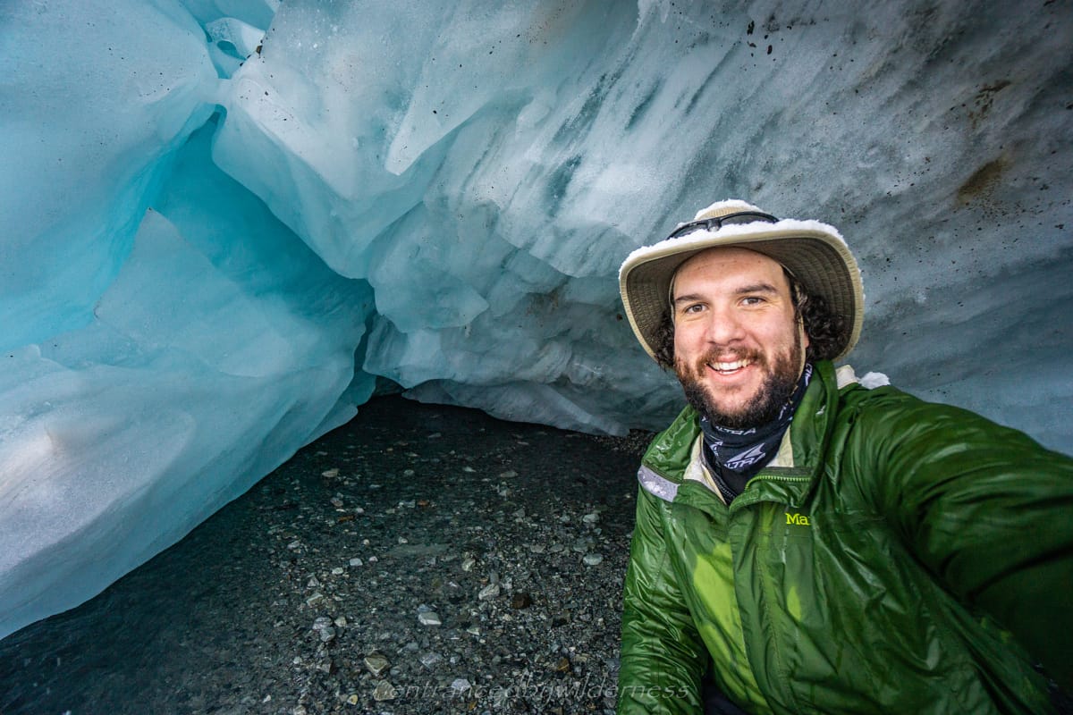
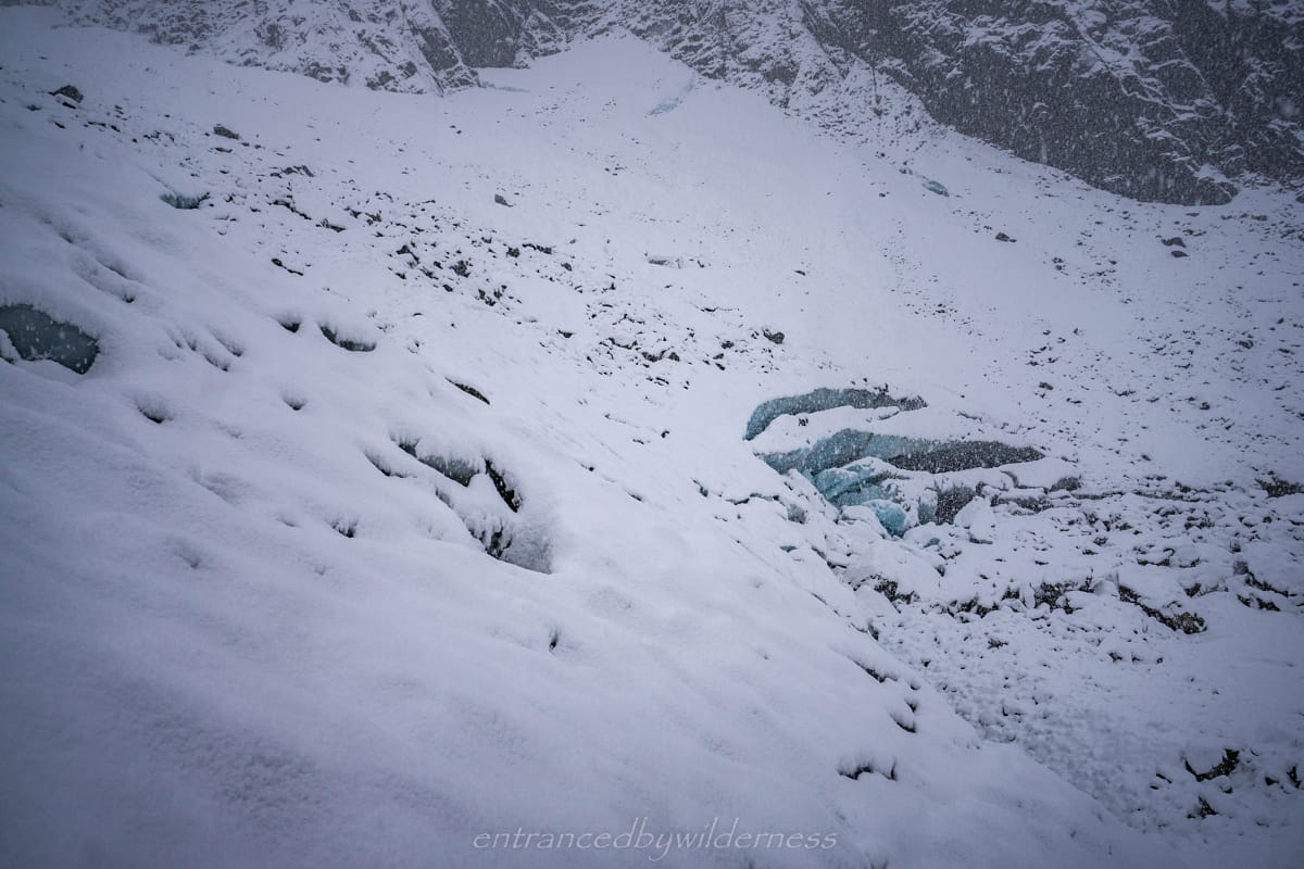
Marmaduke Dixon Glacier
Marmaduke Dixon Glacier was truly more impressive up close than from a distance. It had retreated quite some distance from the location on the topo map, as I was apparently ‘on the glacier‘ according to the map. I was able to stand underneath the ice caves and climb over small sections of the glacier with ease. The snow fall was heavy at this point, so it was a quick decision to head back whilst having some vision. It was fairly easy to follow the footsteps back, although they were filled in with new snow toward the end.
Leaving Barker Hut
After hearing the new weather report, and with no improvement, I made the options to Mel to either: 1) leave right then, whilst conditions aren’t bad with fresh snow and no wind, or 2) wait out a day or two until the snow melts out and rivers recede. Mel agreed with the first choice and we packed up to head out.
Whilst timid with the snow at first, Mel soon became at ease with it and we headed down the steep slopes. The snow was easy to hike over and traction control wasn’t required. We both had microspikes, but it was too soft to use them. Although, the trekking poles were great support! Hiking down in snowfall with zero wind was a truly magical experience.
Accessible Stream Crossings
The stream crossings were certainly higher, but not of a concerning level. We followed roughly the same route back downstream with little event towards Carrington Hut. The snow stopped falling as we reached the main river and turned into sleet and then into rain. The rain was only light however until the very end near the hut.
When we arrived at Carrington Hut, there were about 7 other people there, all kiwis. We ended up chatting to them quite a bit and learning their combined knowledge of the region for potential future routes. I made a mental note to come back another time to climb White Glacier towards Mt Murchison and was very interested in a loop route via Popes Pass as a variant to Three Passes.
Day 4 – Carrington Hut to O’Malley’s Trailhead
The weather this morning was actually looking good. The forecast turned out to be wrong, as it was definitely clearing up. We left Carrington Hut at 8am and began the long walk back to our cars.
The route back was largely monotonous, and we decided to take the forested high route to see what it was like. It wasn’t great! The track is quite rough and at times, hard to find. It ended up adding about an hour to the trip and it was agreed upon that it’s only worth taking if the river was high. We had a break at Anti-Crow hut, which had a young Danish hunter inside. He was basically living out of the hut.
The last few kilometres dragged on a bit and the end was calling, but eventually we made it to our cars at O’Malley’s trailhead. Mel and I said our goodbyes and parted ways, agreeing to return one day for more adventures here.
Summary
Pros:
- Adverse weather creating an unintentional challenging and rewarding experience
- Barker Hut is one of the most impressive hut locations I’ve seen in New Zealand
- The hut is decked out well for just a standard hut with solar power
- Accessibility to glaciers and climbing areas from the hut
- Off the beaten path with few tourists
Cons:
- Almost the entire hike is walking on rocks and takes it out on your ankles
- Walk in and walk out the same way
- Need to focus with head down the whole hike to avoid tripping