
There are lots more Hikes in Patagonia just as epic as the famous Torres del Paine

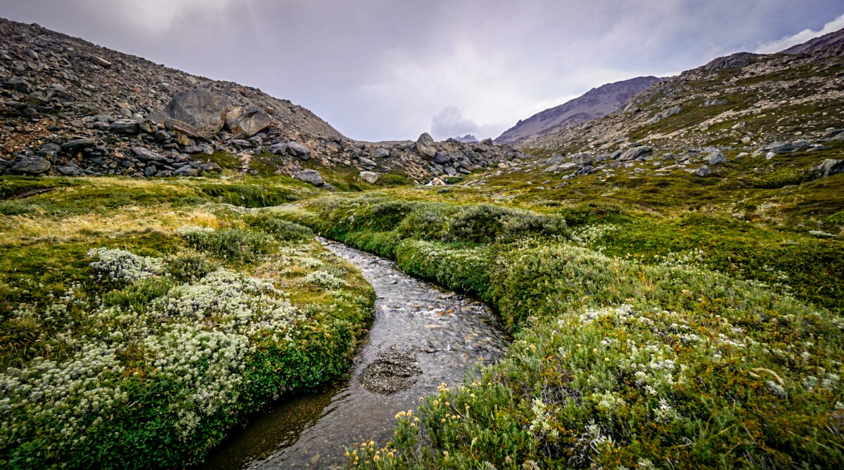
Marsh near Viedma Glacier
Introduction
The ‘lesser travelled’ Patagonia hikes are often hard to find detailed information on. Here, I discuss my experience and information regarding the major multi-day hikes i did in my travels.
Keep in mind that I will omit all day hikes or overnight hikes. You can read more about those hikes in previous posts located here including:
- Huerquehue National Park overnight hike near Pucon
- Lago Lacar day hike near San Martin
- Mt Fitz Roy overnight hike near El Chalten
- Cerro Torre day hike near El Chalten
- Cerro Piltriquitron day hike near El Bolson
Note: I did not do the infamous Torres del Paine hike due to it’s painful three way booking system and sheer mass of tourists there. All the hikes i did were very limited with tourists / other hikers aside from the day trips around El Chalten.

Laguna Cerro Castillo

6 Best Multi-day Hikes in Patagonia
1) Villaricca Traverse
Near the town of Pucon is the very active Mt Villaricca, an active volcano which has erupted numerous times this decade. Talking to the locals about recent events is eye opening!
The Villaricca Traverse is a 5-6 day hike starting from the ski lifts on the mountain, travelling anti clockwise around it’s base. You then bypass its little sister, Mt Quetrupillan, and finally finish up between it and the looming Mt Lanin (on the border with Argentina in map 2). You actually briefly hike in Argentina (without any border checks!).
To get to the ski lifts, you can either walk or get a hitch from just outside Pucon – it’s quite a distance to walk however. You need to first register your hike at the office down the road a little before reaching the ski lifts. You finish up at Mirador Parque Villarrica which is a large area suitable to getting a hitch.
The highlight of this trip for me was seeing the moonlight reflecting off the volcanoes’ glacier with the smoke wisping out the top.

Map 1: Villarrica Traverse 1


Map 2: Villarrica Traverse 2

~ Read more about my Villarrica Traverse hike from a previous post here ~
2) Mt Tronador
The city of Bariloche is on the forefront of mountains, with the glacier covered Mt Tronador beaming in the backdrop to the west. There are many approaches with hiking in this region. I chose a long 8 day hike, but you can go any distance really depending on the route and ending point.
The terrain can be tough at times with the trail being not well marked, sometimes almost fading into scree slopes or into sections where bouldering is required.
I quickly learned how to scree ski (running down loose rocks) on the downward slopes, which was really fun! This hike had some of the most amazing scenery, including the spectacular Lake Azul – the bluest lake i’ve ever seen (named appropriately!).
Camping on the rock surrounded by glacier on Mt Tronador itself was amazing – aside from the strongest winds battering the crap out of everyones tents. I also learned on this hike that hiking through bamboo thickets is NOT a shortcut, especially when it leads into an unmarked swamp (between camp 5 and 6 on map).
To start this hike you need to register at the national park office in the city centre and get a bus out to the ski resort. If you finish up at Pampa Linda, you can also get a bus ride home from there if you make it by a certain time. There you can eat delicious meals and have a few celebratory beers!

Map 3: Mt Trandor (left) and Bariloche (right)

~ Read more about my Mt Tronador hike from a previous post here ~
3) Cerro Castillo
By the time i got to this hike, i had made some friends, most of whom were on the same bus ride to the large town of Coyhaique. After sharing an unforgettable sleeping experience by a stream (because no one would take us in), we all began the hike.
A bus drops you off in the middle of nowhere, and you set out hiking through some agricultural lands before eventually hitting the national reserve. The first actual campsite (labelled camp 2 on map) in the trees and by the river was nice and you could tell looking up into the mountains things were about to change on the next day.
The second day was insanely amazing – we hiked over scree covered glaciers, and witnessed the most spectacular hanging glaciers and cascading glacial meltwaters i’ve even seen. The second day camp was by a spectacular lake and again, under amazing hanging glaciers on the sides of Cerro Castillo itself.
The third day was climbing up and over the southern side of Cordillera Castillo (the peak to the side of Cerro) and into the valley to the west – here we camped in a tight little campsite in the thick forest.
The final day we left camp set up and did a side trip up the Estero Parada to the lakes. Sadly, it was a little foggy this morning limiting the views. We then returned, packed up and headed to the end of the trail near the small town of Villa Cerro Castillo.
It was confusing in Coyhaique where to get a bus ticket at first, but we found an independant guy with a small bus in the centre of the town who drove us. We then left via a second bus from Villa Cerro Castillo which took us to Puerto Rio Tranquillo, our next stop.

Map 4: Cerro Castillo 1


Map 5: Cerro Castillo 2

~ Read more about my Cerro Castillo hike from a previous post here ~
4) Lago O’Higgins to El Chalten (border crossing hike)
Although only a short two day hike, it was an incredible experience. You begin the trip on an early morning ferry from Villa O’Higgins. This was extremely hard to book with so many people back-logged in and wanting to leave (due to a local yearly rodeo festival being on that weekend).
There were two private ferry owners that sold tickets from in the small village. Once off the ferry, you need to go through customs to LEAVE Chile – technically on your passport through this first day hiking, you aren’t…. anywhere! You then reach an Agrentinian customs ‘office’ by the campground where you get stamped in. Waking up by the lake and seeing Mt Fitz Roy in the distance was something special.
You have the option here to take a second ferry, or hike around the outside of the beautiful Lago del Desierto – the second option being the obvious choice! The second section of trail (as soon as you cross into Argentina) on the final day was in rough shape – the bikers who joined up with us hikers on this gnarly trail had a tough time.
We had some ongoing banter with them along the way and a bit of fun at the campground the previous night. You finally arrive at a carpark and road where you get a shuttle bus if you have a large enough group, or hitchhike into El Chalten.

Map 6: Hike begins from Candelario Mancilla and ends at the end of Lago Desierto
~ Read more about my Lago O’Higgins to El Chalten hike from a previous post here ~
5) The Huemul Circuit
After hiking the easy day hike to Cerro Torre and overnighting at Mt Fitz Roy, a more challenging hike was appealing. The hikes very existance escaped me prior to arriving in El Chalten – it was much newer and less accessible due to its difficulty. It is a 3-4 day hike with many different experiences along the way.
The Humeul circuit requires you to take a harness to cross two ziplines – one over a steep gorge, the other over a wide river. To acquire these, you need to reserve them at one of two or three vendors in town (pricey, but not budget breaking).
You then need to register for free at the national park office where the trail starts prior to leaving – they often have rangers checking permits here and will usher people out without them with threats of fines (trust me, i know!).
It was a pretty simple first day hiking over the grassy hills through marshes and down into the valley below. The next day involves the first zipline crossing over a river cut gorge, crossing an aptly named ‘Paso del Viento’ (Pass of the Wind) – very windy at times!
The blue asterisk on map 7 below marks the best view i’d seen on any hike to date – a view of the endless glacial icefield that feeds Viedma Glacier and part of the 3rd largest glacier in the world! Campsite 2 has a cozy small shelter to cook and hang out in, and is next to a lovely little fresh stream. The third day involves a strenous and steep climb and descent, but again offers amazing views.
You can camp at the typical campground (marked ‘3’ on map 7) or do what i did and go furthur up towards the start of the peninsula and camp behind the rocky beach there with amazing views of Viedma glacier – you’ll even have chunks of glacier floating up! The last day is a long but easy hike – not as scenic as the first few days, but still great.
The zipline finale is a good end to the hike (Rio Tunel). It looks easier than the first zipline, but it’s much harder to pull yourself accross as it is quite flat and you need to go upwards toward the end.
I recommend attaching your pack on a separate carabiner and grasping it between your thighs as you cross as it is easier to dismount. A lucky hitch fropm the ferry carpark will get you back to El Chalten, or you could just walk.

Map 7: Huemule Circuit
~ Read more about my Huemul Circuit hike from a previous post here ~
6) The Dientes Circuit
The southern-most officially marked trail in the world! It is situated on Isle Navarino (see map 8) in Chile, just below the city of Ushuaia in Argentina. To get there, you must travel by overnight ferry from Punta Arenas in Chile, or ferry from Ushuaia (border crossing).
It’s VERY expensive either way, but worth it! I came via Punta Arenas and travelling the Beagle Channel made it all the worthwhile – loads of seals and even a few humpback whale calves swam by the ship!
Staying at Refugio El Padrino with the hostess Cecilia is a must – this lady is amazing! She will even drive you to the trailhead. The Dientes Circuit is classed as a 4 day hike, but that would mean very small days.
You could easily do it in three, or two very big days. I chose to lengthen my hike by including the lesser travelled Lago Windhorn path, where i stayed two nights at the cabin on the northern side of the lake (see map 9). This made my hike about 5 days in total.
This alternate to Lago Windhond was what made this hike so amazing for me (even more that the entire Dientes Circuit) and was one of my favourite moments in Patagonia – this is the furthest point south i’ll probably ever hike!
There is a cabin at the end containing several bunks and a barrel wood stove. You can attempt fishing using the lines there or just lay out in the hammock reflecting on how you are one of the most southern people in the world.
In the guestbook contains many hand drawn maps of routes people made to peaks or around Lago Windhond itself. The weather was quite rough when i was there, and snow fell on two days when on top of the higher peaks and passes.
Be sure you have a good windproof jacket, and a buff to protect your face! Most of the hike is on rocky scree or wet marshy bog. Prepare for muddy shoes! 😀

Map 8: Isle Navarino Location

Map 9: Dientes + Lago Windhond Circuit

Map 10: Dientes Circuit

The only photo (off phone) i have from this trip is from the guestbook in the cabin at Lago Windhond, where i describe my experience (lost camera later into my trip)
The hikes i did in Patagonia were all awesome. I did miss a few key ones that i will certainly complete on my next Patagonian adventure!

Summiting Cerro Quitruipiltran near El Bolson

~ Read about one of my favourite Patagonian hikes in more detail here ‘Cerro Cathedral (near Bariloche) to Mt Tronador – Patagonia: Multi-day Hiking Trip‘ ~
In order to support the travelling and hiking community, I spend many hours per week or month to adequately document all information and advices for prospective visitors. This, accompanied by a (hopefully) entertaining insight into my personal experiences. This service is and will remain free. However, if you voluntarily want to make a contribution and support my travels and thus the creation of new stories and hiking information, here is the button you’re looking for:
Thank you for reading 🙂