"A historical wander, through stunning forest, tussock and sub-alpine scenery"
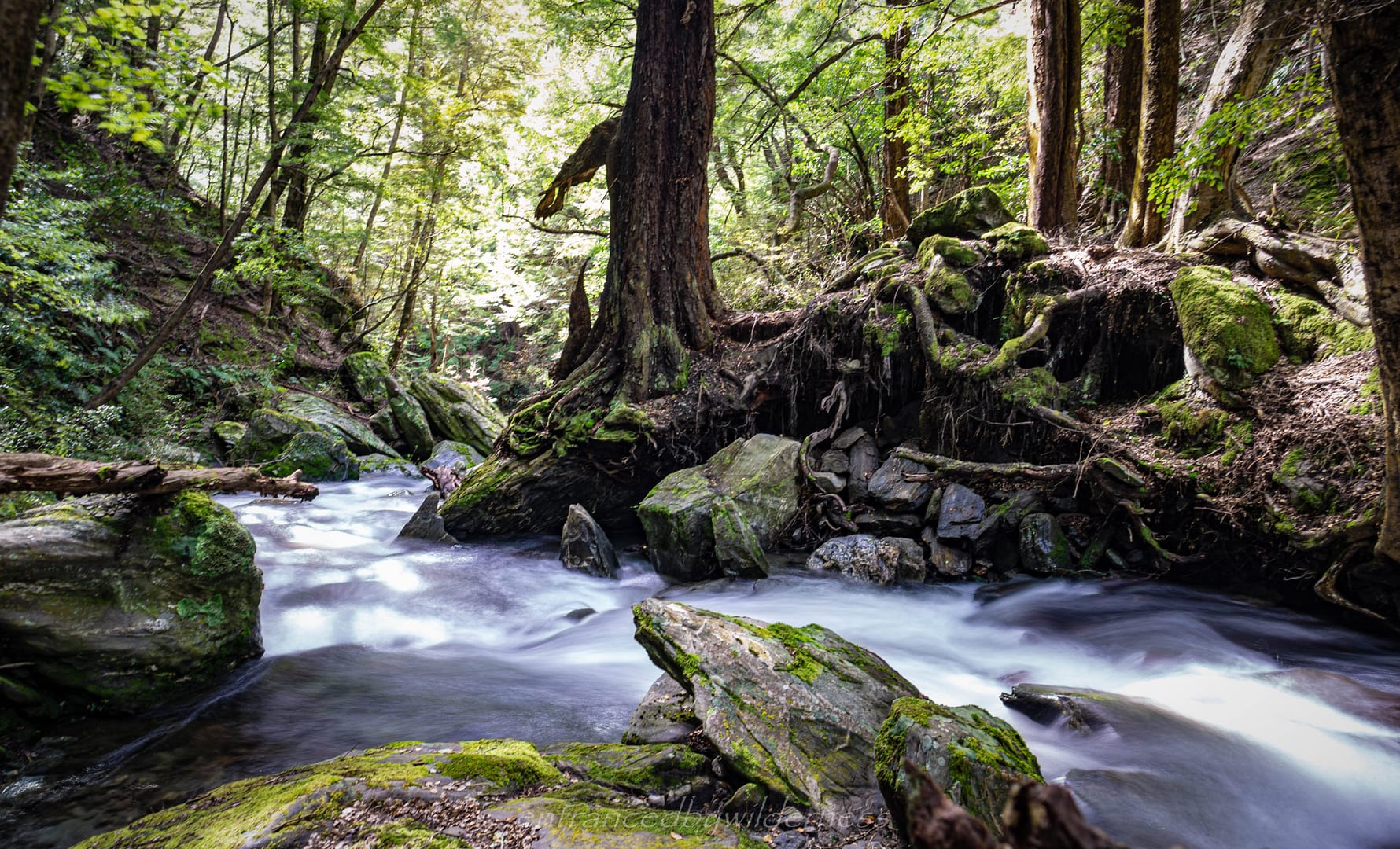
The Fern Burn is a highlight on the Motatapu Track
Map of Route
Hike Information
Location:
The Motatapu Track lies between Arrowtown and (near) Wanaka, at Glendhu Bay. Aside from the Arrow River and Fern Burn, the route mostly crosses private lands, however, a partnership with DoC is established for public access.
Difficulty:
Intermediate to Advanced – Whilst this is by no means a hard hike for navigation, or technical terrain, it is physically demanding. You must have a decent level of fitness to attempt, as the terrain is undulating.
Camping:
There is one campground, and three DoC huts on this route. Macetown offers a pit toilet and plenty of space to tent. Note that 4WD vehicle access leads to here too. The 3 huts are much the same in style, dispersed at intervals from Macetown to Glendhu Bay. Due to most of the track being on private land, I would expect wild tent camping to be discouraged, aside from along the Arrow River and Fern Burn.
Time:
The track should take 3-4 days for most people. I did it in 3 days, with a pretty solid first and second day. Allow time for a hitch at Glendhu Bay if finishing on that side.
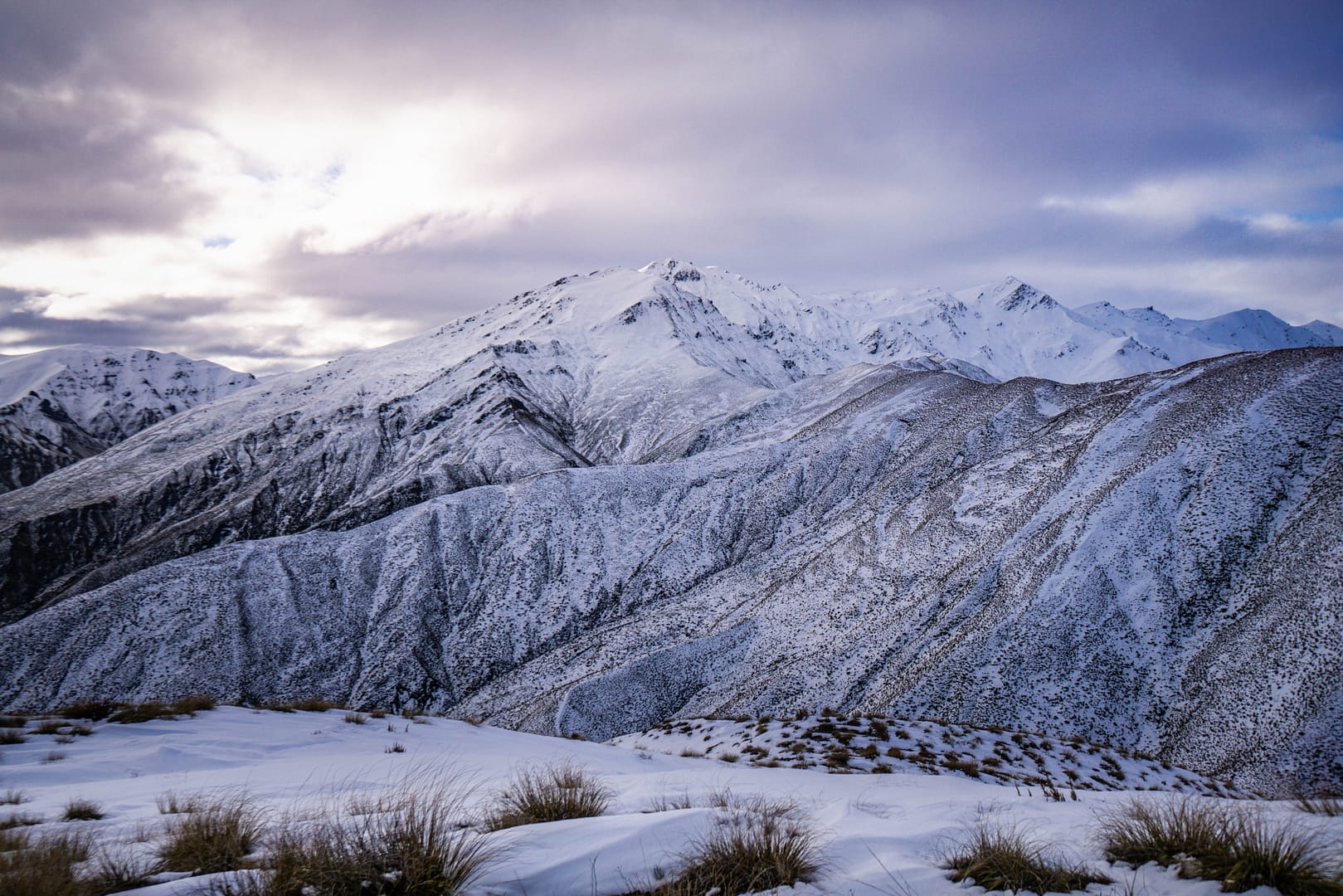
Some of the mountains you see on the Motatapu Track
My Trip
30/09/2020 – 02/10/2020
Introduction
One hike right at my doorstep living in Queenstown that I’ve always wanted to do, was the Motatapu Track. However, I had always left it as a backup option, due to it being logistically challenging, with the start and finish locations being so far apart.
A cold Antarctic blast had just hit, dropping low snow in all the ranges of South Island – this would make for picturesque hiking conditions, so I decided now was the time!
Day 1 – Arrowtown to Roses Saddle
It was around 9am that I had arrived at Arrowtown carpark, pack on, and ready to hike! I had no real expectation of how far I’d get that day, but the goal was to get past Macetown, perhaps to Roses Hut.
The start of the hike was along the Bush Creek Track, before turning north toward Big Hill.
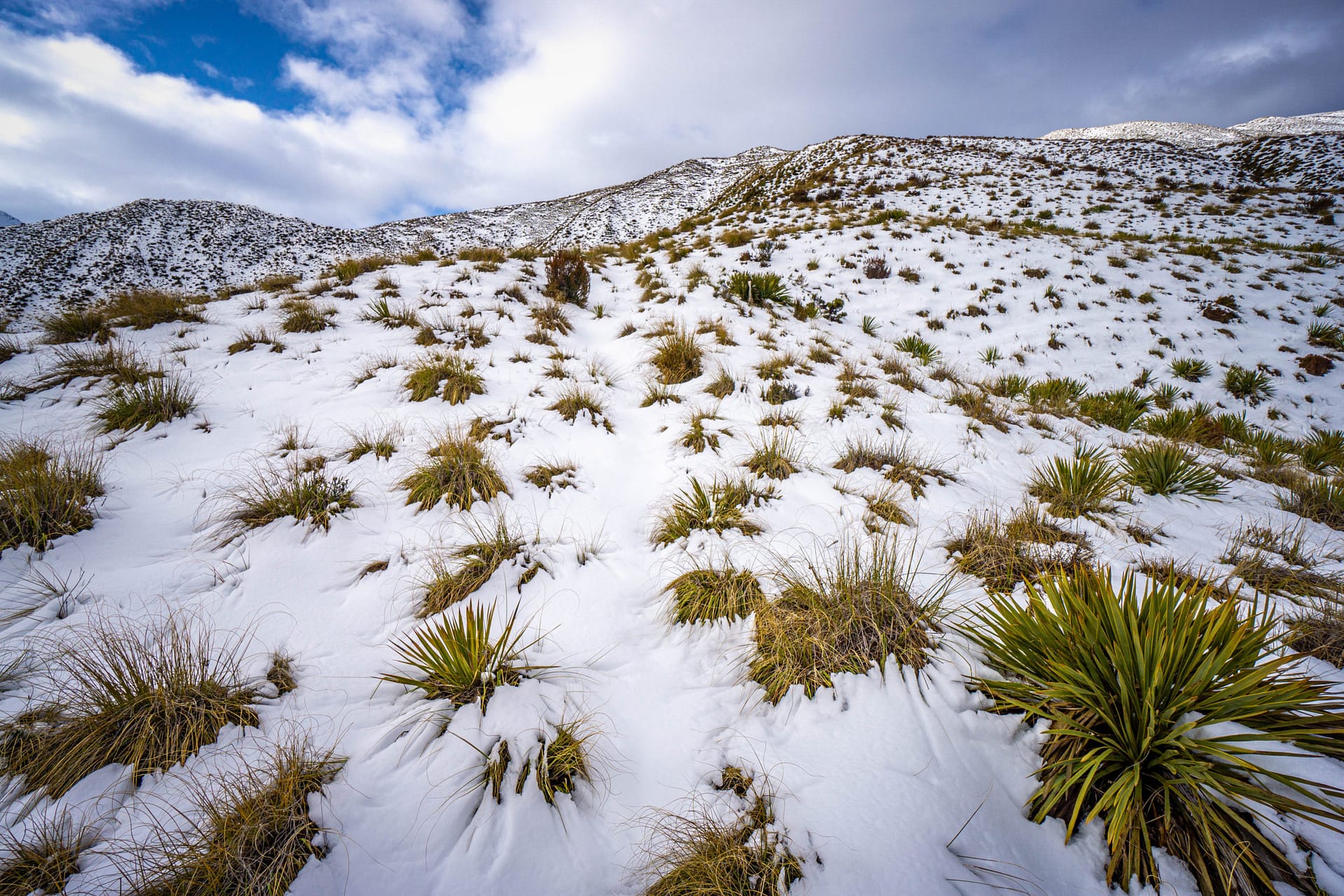
The snow became evident around 600m and above, mostly in the forested sections. It was so awesome to view the transformed landscapes dusted with snow! With the cold snap over from the previous days, the snow was light and easy to hike through without worrying about traction control.
Eventually, the snowy ascent led to the small saddle below Big Hill. Once here I needed to descend towards Coronet Creek, and on towards the Arrow River. It surprised me that there wasn’t as well of an established trail here as I would have expected, being part of the Te Araroa trail and all, but it was pretty easy to follow all the same down through the tussock and shrubs.
At the confluence of Coronet Creek and the Arrow River, I began to make my way north. Eventually, I arrived at Macetown, a historical gold mining settlement up until the early 1900s. There are a few sites around to see here, along with a long drop toilet and plenty of space to camp. I thought about camping here, but I had plenty of time, and wanted to get up to Roses Saddle to camp.
From Macetown, I decided to take the low route following the Arrow River, and not the high track. It wasn’t the lowest of flows, but it certainly wasn’t high. There’s no trail in this section, it’s mostly just following the 4WD track, and crossing the river repeatedly. It was quite nice, despite being pretty chilly with all the snow melt now feeding it.
There was a slightly challenging part with the medium flow south of Peak 991m, where the gully narrowed and the river was a little more ‘pushy’. The banks were heavily covered in Matagouri bush, and some areas required crawling. The river is still the easier option here.
Even so, the Matagouri STILL managed to snag my newly bought cap (after my previous one was blown off a mountain the hike before!). The cap ended up drifting too fast downstream for me to get it *sigh*… “farewell!”. The problem now was, that my damn hair was free to get caught in the damn bush! I was pulling spikes out of my hair for ages to come!
For some random reason, I took the high track route for the final section of the Arrow River, but it would have been just as easy to stick to the river in the end.
I made my way up the spur toward Roses Saddle as the final push for the day. Roses Hut was a possibility to stay in, but I really wanted to snow camp just once more this year whilst the snow was around.
By the time I reached around 1200m elevation, I was pretty spent. It had been a massive day of hiking, and my pace dropped to a crawl. Although there was relatively thick snow in places to camp, it was mostly ‘floating’ on vegetation, with loads of air pockets underneath. This didn’t stop be compacting out a section, though, and camp was made!
Thankfully, the snow served as an easy water source to replenish my supplies and prepare dinner. Noodles and tuna tonight! As I cooked and ate, I marvelled at the serenity and the sunset looming over the peaks in the distance. This was living!
I set off in the morning fairly relaxed with no great rush. My destination was going to be Highland Creek Hut, which via the map, didn’t look like it would be too hard a day to accomplish.
I only had a few hundred metres to reach Roses Saddle. I could finally now see into the Motatapu River valley. The mountain range north-west of me looked amazing from here. I could pinpoint Roses Hut in the distance as I began to descend.
Although I didn’t really need to go via it, I had a quick look at Roses Hut. No signs of life! I preferred my snow perch camp anyway!
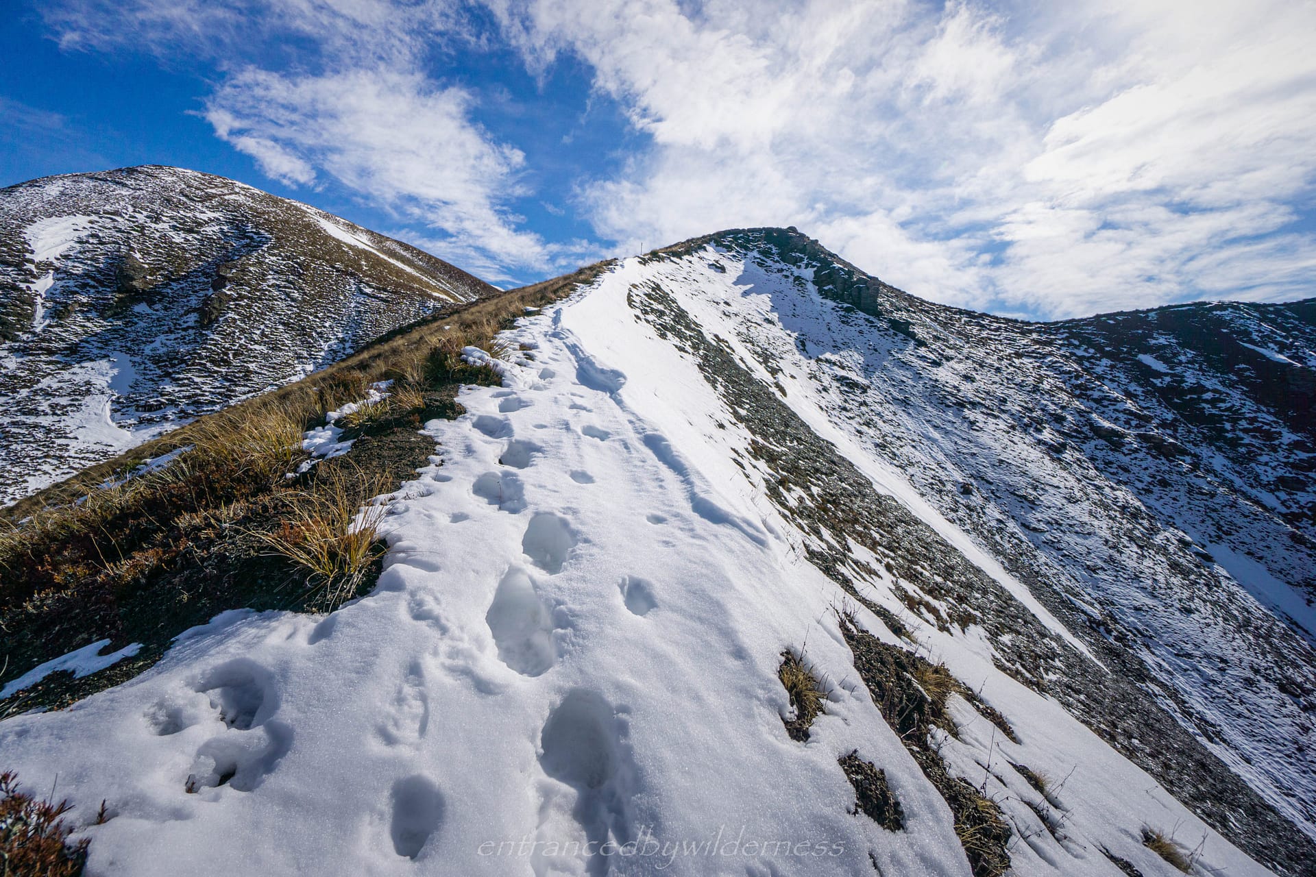
From here, you cross the Motatapu River (South Branch) across to the spur leading to Knuckle Peak. This section is about 500m or relatively steep climbing, and being a little unfit along with the huge previous day, it definitely took it out of me!
There was a large slip under the trail to get around before you can safely descend the spur into a small gully with beech forest. It was nice to briefly be back in the trees, with a nice refreshing stream.
Alas, it was time again, for yet another climb – another 500m! It wasn’t a fast climb by any means, but I eventually got to the fence line and stall.
After getting over the fence and down the cornice of snow, it was time for the final (I think!) descent into Highland Creek valley. I was nearing Highland Creek Hut, and I could see it off in the distance as I made my way down the sharp spur.
I remember vividly reaching a small creek that had a short 50m climb behind it, and just laying down exhausted on the grass for about 15 minutes. As my dad said upon his first visit to the Southern Alps in New Zealand… “Blocks of Toblerone… everywhere!“. Well, I certainly got a taste of that today. Everything felt Tobleroney!
I reached the hut in the late afternoon, and appreciated just having quite downtime. No one else was there, or had been for a few days (according to the log book) – perfect!
It did grow a little windy that evening, but thankfully, the protection of the hut was there.
In the morning, the wind had ceased, and was back to good weather. It was meant to be a little rough in the afternoon though, so I needed to ensure I made it out in time.
My next venture, was heading up and over point 1267m, and into the Fern Burn valley. This began as more ups and downs followed by a final roughly 380m ascent to 1267m.
Finally, the rest of the hike was all a gentle downhill, and was quite easy in general. In the distance, I could make out Fern Burn hut. I knew this hut was quite popular, which is also why I never intended on staying there. However, to my surprise, it was also empty the previous night! Post-Covid hiking is glorious!
After the hut, there was a small river crossing (I managed a jump across) and then a scramble up a heavily eroded trail. The valley steepens, so the trail is cut into the side of the valley above the burn itself.
Eventually, you end up in stunning Beech forest, with a spectacular waterfall not far in!
As you progress further into the forest there is a stunning section worth having a break at. It’s like something out of a fairytale. I didn’t expect the Fern Burn to be this pretty.
After being memorized by the pretty section of trail, I continued on. I crossed a small bridge and eventually came to be looking down on a flat section below the trail that looked stunning to camp at (and was public conservation land). I made a mental note to return to here in the future for an overnighter!
Before long, the forest subsided, and farmland took over again. There was about 3km left, before hitting the carpark. Thus, ending my trip on the Motatapu Track.
Due to the fact it was a fairly un-used dirt road, I decided to just walk out and try to hitch from the Wanaka Mount Aspiring Road near Glendhu Bay. This was a further 2.5km of walking, but the weather was holding, so I didn’t mind. Right when I got to the end, I got a hitch from hikers who had left after me, and they dropped me off in Wanaka.
I had the final task of then getting ANOTHER hitch back to Queenstown. I decided the best spot was on the hill near the golf course, but luck wasn’t with me. It ended up taking about 45 minutes, before finally, a lovely elderly man gave me a ride who was visiting his son in Queenstown.
Summary
Pros:
Variety of terrain for hiking: trail, river and snow
The challenge level is medium-high, yet completely accessible for anyone at the same time
Not full of people, and only some of which has 4WD access
Highland Creek Hut area felt nice and remote
Beautiful forests in the Fern Burn
Cons:
The logistics of completing the trail one way means unreliable hitching is required, or pre-planning with two vehicles
Doesn’t really reach high elevations or peak summits without undertaking side-trips
The fact a lot of it is private property with fencing takes away from the nature a little
Your Donation Really Helps!
In order to support the travelling and hiking community, I spend many hours per week or month to adequately document all information and advice for prospective visitors, accompanied by a (hopefully) entertaining insight into my personal experiences. This service is, and will remain, free. However, running a non-profit website and spending time creating content comes with financial and personal costs.